
Conduct an environmental health records search in California using our environmental health records resources.
View our environmental health records resources for the state of California. Use these environmental health records to view flood zone maps, conduct a permit search, and to search for other essential data about environmental health. Environmental health records may contain flood zone areas, permit search help, GIS mapping resources, and other environmental health information.

| County | Resource | Details |
|---|---|---|
|
Search California Department of Toxic Substances Control for properties where extensive investigation and/or cleanup actions are planned or have been completed. Searches include Federal Superfund sites, State Response sites, and more. |
||
|
Search California Water Quality Monitoring Council for water quality information of California. Available water quality data includes Is Our Water Safe to Drink; It is Safe to Swim in our Waters; Is it Safe to Eat Fish from our Waters; Are our Aquatic Ecosystems Healthy; Are harmful Algal Blooms Affecting our Waters; and Is there Monitoring Data Near Me. |
||
|
View the California Office of Environmental Health Hazard Assessment interactive map of water bodies in California where chemical contamination in fish poses a health concern. Website provides such topics as Fish Advisories; Benefits and Risks of Eating Fish; Oil Spills and Seaford; Chemicals in Fish; and more. |
||
|
View California Air Resources Board air quality data for various pollutants throughout the state. Available statistics include Air Quality Summaries Tailored to Your Needs; Air Quality Trends Summaries; Top 4 Measurements and Days Above the Standard; 24 Hourly Measurements for a Site and Day; Daily Statistics in a 10-Week Listing; and Statewide and Site-by-Site Toxics Summary Statistics. |
||
| orange county |
Search interactive City of Garden Grove GIS map for zoning districts, benchmarks, flood zones, land use, parks, open space, and points of interest. Search by APN or address. |
|
| orange county |
View the City of Anaheim drinking water quality reports from 2004 to present. |
|
| orange county |
View a map of the City of Fountain Valley flood zones. |
|
| orange county |
View the City of Fountain Valley annual drinking water quality reports from 2009 to present. |
|
| orange county |
View the City of Garden Grove most recent annual drinking water quality report. |
|
| orange county |
View various City of Huntington Beach GIS maps including flood hazard areas, general plan, tsunami evacuation, schools and districts, zoning designations, points of interest, and general city map. |
|
| orange county |
View the City of Huntington Beach most recent drinking water quality report. |
|
| orange county |
Search interactive City of Irvine GIS map for parcel information such as address, general plan designation, zoning, homeowner association, and flood zone map information. Search by address, Assessor's Parcel Number (APN), tract and lot numbers, or cross-streets. |
|
| orange county |
View the City of La Habra 2011 drinking water quality report. |
|
| orange county |
Search interactive City of Laguna Niguel GIS map by address, APN, or street name. Information available includes zoning information, flood zone, school attendance areas, utility services, trash pickup day, street sweeping day, latitude and longitude, and building permit history. |
|
| orange county |
View various static City of Rancho Santa Margarita GIS maps including general plan, zoning, aerial photos, streets, flood hazards, parks, and school districts. |
|
| orange county |
Search interactive City of San Clemente GIS map by address or APN. Results include basic parcel information, city facilities, FEMA flood zones, open space, landmarks, parks, trails, beach access, and aerial photos. |
|
| orange county |
View bacteriological water quality data for Orange County recreational waters including data on sewage spills and related ocean, harbor and bay water closures. |
|
| los angeles county |
Search interactive City of Santa Monica GIS maps including crime incidents, points of interest, property assessment records, street centerline ties and benchmarks. |
|
| los angeles county |
View static and interactive City of Carson GIS maps including property information, voting precincts, schools, zoning, elevation contours, street index, aerial images and more. |
|
| los angeles county |
Search interactive City of Santa Clarita GIS map for property related information. Search by parcel number, address, or tract number. Map also provides topography, aerials, flood zones, and zoning districts. |
|
| los angeles county |
View the City of Arcadia annual drinking water quality report. |
|
| los angeles county |
View the City of Bellflower water quality reports from 2006 to present. |
|
| los angeles county |
View the City of Burbank water quality reports from 2000 to present. |
|
| los angeles county |
View the City of Glendale water quality reports from 2005 to present. |
|
| los angeles county |
View the City of Huntington Park annual water quality report. |
|
| los angeles county |
View various City of Lakewood maps including streets, parks, regional, zoning, school districts, and flood insurance rate maps. |
|
| los angeles county |
View the City of Lakewood most recent annual drinking water quality report. |
|
| los angeles county |
View the City of Long Beach annual water quality report from 2008 to present. |
|
| los angeles county |
Search interactive City of Los Angeles flood zone map by property address. Results include flood flood status, base flood elevation, flood depth, panel number and effective date. |
|
| los angeles county |
View the City of Monterey Park most recent annual drinking water quality report. |
|
| los angeles county |
View the City of Pomona 2012 drinking water quality report. |
|
| los angeles county |
View Los Angeles County water quality reports from 2009 to present. |
|
| los angeles county |
View various static City of Santa Clarita GIS maps including annexations, traffic, zoning, street, hazard zones, planning, flood zones, and streets. |
|
| yolo county |
View the City of Davis annual drinking water quality reports from 2008 to present. |
|
| yolo county |
Search interactive Yolo County GIS map for flood zones, major roads and highways, zoning, school districts, and more. |
|
| ventura county |
View the City of Simi Valley environmental documents for planning projects under review. |
|
| ventura county |
Search interactive City of Thousand Oaks GIS map for parcel reports with basic property and zoning information, city facilities, historic landmarks, flood zones, and more. Search by address, APB, location ID, or tract lot. |
|
| ventura county |
View Ventura County food facilities closure report. |
|
| tulare county |
View the City of Tulare annual drinking water quality reports from 2008 to present. |
|
| sonoma county |
View the City of Petaluma environmental impact reports related to various development projects under review. |
|
| sonoma county |
View the City of Petaluma annual drinking water quality reports from 2010 to present. |
|
| solano county |
View the City of Fairfield annual drinking water quality reports from 2003 to present. |
|
| sierra county |
View Sierra County 2011 drinking water quality report. |
|
| shasta county |
Download the City of Redding GIS data files including flood zones, parcels, land use, zoning, parks, police beats, fire station locations, subdivisions, and redevelopment project areas. |
|
| shasta county |
View the City of Redding annual drinking water quality reports from 1999 to present. |
|
| shasta county |
View Shasta County environmental impact reports for planning projects under review. |
|
| santa clara county |
Search the City of Milpitas public documents archive including ordinances, resolutions, agendas, minutes, building permits, hazardous material business plans and permits, fire projects, and campaign statements. |
|
| santa clara county |
View various City of Cupertino GIS maps including property information, street index, zoning, land use, street sweeping, and FEMA flood zones. |
|
| santa clara county |
View the City of Gilroy annual drinking water quality reports from 2007 to present. |
|
| santa clara county |
View various City of Milpitas GIS maps including zoning, general plan, flood hazards, searchable neighborhood maps, aerial photographs, and shapefile data. |
|
| santa clara county |
Search for the City of Palo Alto flood zone information by address. |
|
| santa clara county |
View various City of Palo Alto maps including parks and facilities, flood zones, historic districts, streets, licensed child care centers, trails, zoning districts, and public internet access locations. |
|
| santa clara county |
View Santa Clara County environmental impact reports, environmental assessments, and negative declarations. |
|
| santa barbara county |
Search interactive Santa Barbara County GIS maps including flood zone data and recorded land survey information. |
|
| santa barbara county |
View the City of Santa Barbara environmental documents for planning projects under review. |
|
| san mateo county |
View interactive and static San Mateo County GIS maps including parcel viewer, beach and creek water quality monitoring, map atlas, supervisor districts, earthquake faults, and grid boundaries. |
|
| san mateo county |
View San Mateo County beach, pool, and other recreational water locations that have elevated levels of indicator bacteria. |
|
| san mateo county |
Search interactive City of Redwood City GIS map for general parcel information, zoning, issued permits, FEMA panel number, and points of interest. Search by address or parcel number. Map also includes parcel boundaries, zip codes, FEMA flood zones, land use, historic districts, and other layers. |
|
| san mateo county |
View the City of Redwood City annual drinking water quality reports from 2004 to present. |
|
| san mateo county |
View the City of San Mateo original FEMA flood insurance rate map and revisions. |
|
| san luis obispo county |
View the City of San Luis Obispo annual drinking water quality reports from 2008 to present. |
|
| san luis obispo county |
View San Luis Obispo County annual drinking water quality reports from 2009 to present. |
|
| san joaquin county |
View the City of Tracy environmental impact reports for planning projects currently under review. |
|
| san diego county |
Search interactive San Diego County GIS maps including political districts, emergency service, zoning and general property information, wildfire information, watersheds, general planning and conservation maps. |
|
| san diego county |
View the City of Carlsbad most recent annual drinking water quality report. |
|
| san diego county |
View the City of Escondido current planning projects and and environmental impact reports. |
|
| san diego county |
View the City of Oceanside current FEMA flood insurance rate maps. |
|
| san diego county |
View the City of Oceanside most recent annual drinking water quality report. |
|
| san diego county |
View the City of Poway environmental documents for planning projects that are currently under review. |
|
| san diego county |
View the City of San Diego annual drinking water quality reports from 2001 to present. |
|
| san diego county |
View the City of San Marcos environmental documents for planning projects that are currently under review. |
|
| san diego county |
View San Diego County environmental documents for planning projects currently under review. |
|
| san diego county |
Search San Diego County hazardous materials database for information such as CUPA facility permit number, business address, business name, hazardous waste and materials inventory (for active sites only) and underground storage tank information. Search by establishment name, establishment number, address, city, or zip code. |
|
| san bernardino county |
View various interactive and static City of Redlands GIS maps including polling locations, zoning, points of interest, crime locations, flood zones, and historical atlas. |
|
| san bernardino county |
View the City of Chino Hills most recent annual drinking water quality report. |
|
| san bernardino county |
View the City of Colton FEMA flood maps by map number. |
|
| san bernardino county |
View the City of Colton most recent annual drinking water quality report. |
|
| san bernardino county |
View the City of Fontana environmental documents for planning projects currently under review. |
|
| san bernardino county |
View the City of Hesperia annual drinking water quality reports from 2002 to present. |
|
| san bernardino county |
View the City of Upland annual drinking water quality reports |
|
| sacramento county |
View various static City of Sacramento GIS maps including land use, zoning, Council districts, neighborhood, historic, street and flood maps. |
|
| sacramento county |
View the City of Folsom annual water quality report. |
|
| sacramento county |
View the City of Rancho Cordova environmental impact reports, initial studies, and negative declarations for planning projects under review. |
|
| riverside county |
Search for the City of Temecula public records including survey records, recorded parcel and tract maps, environmental constraint ?sheets, ordinances, resolutions, agendas, minutes, campaign filings, and building permits. |
|
| riverside county |
View the City of Hemet annual water quality reports. |
|
| riverside county |
Search interactive City of Temecula GIS map by APN, address, street intersection, tract map number or name. Map layers include fault zones, flood plains, high fire zones, environmentally sensitive areas, parks, points of interest, land use and zoning. |
|
| riverside county |
Search interactive Riverside County GIS map for basic property information, building permits, planning cases, flood zones, environmental health permits, and historic preservation districts. Search by APN, address or legal description. |
|
| placer county |
View various static City of Rocklin GIS maps including base, general plan, benchmarks, flood zones, and zoning. |
|
| placer county |
View the City of Rocklin environmental documents including approved environmental impact statements and current environmental documents. |
|
| napa county |
Search for Napa County contaminated sites and hazardous materials by site name or location. |
|
| merced county |
Search for Merced County archived documents including rural crime reports, District Attorney's press releases, environmental documents, agendas, minutes, newsletters, and reports. Search by keyword, document type, or date range. |
|
| merced county |
View various Merced County GIS maps including land use planning, assessor book, Board of Supervisor districts, cemetery districts, voting precincts, environmental health, FEMA flood, graffiti sites, and irrigation districts. |
|
| merced county |
View the City of Merced most recent drinking water quality report. |
|
| merced county |
View Merced County environmental impact reports, initial studies, mitigated, and negative declarations for planning projects under review. |
|
| madera county |
View the City of Madera most recent water quality report. |
|
| inyo county |
View a complete list of environmental project documents that have been filed in the Inyo County Clerk's Office pursuant to the California Environmental Quality Act (CEQA) from 2010 to present. |
|
| fresno county |
View the City of Clovis annual water quality reports. |
|
| fresno county |
Search interactive City of Fresno GIS map by address, parcel, or intersection. Results provide school district, flood insurance rate map, zoning, land use designation information, etc. |
|
| contra costa county |
View the City of Brentwood annual water quality reports from 2009 to present. |
|
| butte county |
View various maps of Butte County, including supervisor districts, schools, parks and recreation, incorporated areas, planning and land use, watershed and shaded relief maps. |
|
| butte county |
View Butte County annual air toxics hot spots report. |
|
| alameda county |
Search interactive City of Fremont GIS maps including land use, FEMA flood information, survey monument details, public facility locations, business research information, and aerial views. |
|
| alameda county |
View various City of Berkeley GIS maps including property and planning, Council districts and voting precincts, historic resources, transportation, recreation, redevelopment, and environmental maps. |
|
| alameda county |
View the City of Hayward annual water quality reports. |
|
| alameda county |
Search interactive map for leaking underground storage tanks in Alameda County. Search by business name, address, or record ID. |
|
| marin county |
Search various interactive Marin County GIS maps including agricultural parcels, property information, zoning and planning information, environmental policy data, parks and trails, conservation areas, and district boundaries. |
|
| mendocino county |
View various Mendocino County GIS maps including soils, zoning districts, fire hazards, school districts, supervisorial districts, and FEMA flood insurance rate maps. |
The information provided on this website about U.S. States, Counties, and Cities, is compiled from publicly available sources and is made available “as is” for informational purposes only. No representations, warranties or guarantees are made as to the accuracy, adequacy, reliability, currentness, completeness, suitability or applicability of the information contained on this website for any particular purpose. All 3rd party trademarks are for reference purposes only. PublicRecords.com powered by Intelius is a privately owned website and is not a direct source of government records or services and not affiliated with any government agency.
Below, you will find a list of offices in California that may hold environmental health records. When requesting environmental health records from these offices, it's important to be aware of any procedures, requirements, and fees associated with obtaining the records. Contacting the respective office directly will provide you with the most accurate and up-to-date information regarding access to environmental health records in California.
| Image | Office | Address | Phone |
|---|---|---|---|
 |
30 Mansfield Rd, Hollister, CA 95023 | (831)-637-8218 | |
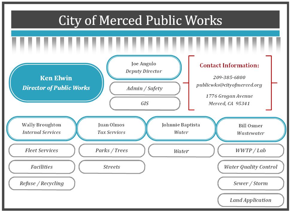 |
City of Merced Finance Department Water-Sewer-Refuse Billing |
678 W 18th St, Merced, CA 95340 | (209)-385-6841 |
 |
11 Reservation Rd, Marina, CA 93933 | (831)-384-6131 | |
 |
135 S Jackson St, Independence, CA 93526 | (760)-878-0001 | |
 |
160 Calle Magdalena, Encinitas, CA 92024 | (760)-633-2650 | |
 |
13805 Llagas Ave, San Martin, CA 95046 | ||
 |
5026 Don Julio Blvd, Sacramento, CA 95842 | (916)-875-6730 | |
 |
300 Bridge St, Bieber, CA 96009 | ||
 |
Contra Costa Water District Seminary Reservoir & Pump Station |
Marsh Creek Rd, Clayton, CA 94517 | (925)-688-8000 |
 |
8691 Quincy La Porte Rd, Brownsville, CA 95919 | (530)-675-2567 | |
 |
409 Old Baldwin Rd, Ojai, CA 93023 | (805)-646-3403 | |
 |
18050 Box Factory Rd, Tuolumne, CA 95379 | (209)-928-3517 | |
 |
32750 Woollomes Ave, Delano, CA 93215 | (661)-725-8172 | |
 |
4525 Franklin Rd, Yuba City, CA 95993 | (530)-673-7138 | |
 |
1 The Plz, Sonoma, CA 95476 | (707)-933-2244 | |
 |
7300 Short Rd, Soda Springs, CA 95728 | (530)-426-7800 | |
 |
836 Anacapa St #155, Santa Barbara, CA 93102 | (805)-963-3669 | |
 |
567 El Camino Real, San Bruno, CA 94066 | (650)-616-7086 | |
 |
1005 S Broadway, Santa Maria, CA 93454 | (805)-928-8349 | |
 |
525 Golden Gate Ave, San Francisco, CA 94102 | (415)-551-3000 | |
 |
1350 S E St, San Bernardino, CA 92408 | (909)-384-5141 | |
 |
24501 School Rd, Ripley, CA 92225 | (760)-922-4909 | |
 |
3101 Center St, Placerville, CA 95667 | (530)-642-5225 | |
 |
18700 Ward St, Fountain Valley, CA 92708 | (714)-378-3200 | |
 |
955 School St, Napa, CA 94559 | (707)-257-9508 | |
 |
320 W Newmark Ave, Monterey Park, CA 91754 | (626)-307-1342 | |
 |
16943 Rd 26, Madera, CA 93638 | (559)-674-4944 | |
 |
Los Angeles Department of Public Works - Water Works District |
260 E Avenue K 8, Lancaster, CA 93535 | (877)-637-3661 |
 |
501 Taft Hwy, Bakersfield, CA 93307 | (661)-834-4656 | |
 |
39360 Solitude St, Shaver Lake, CA 93664 | (559)-841-2394 | |
 |
9829 Waterman Rd, Elk Grove, CA 95624 | (916)-685-3556 | |
 |
840 Main St, Colusa, CA 95932 | (530)-458-4266 | |
 |
120 Toma Ct, San Andreas, CA 95249 | (209)-754-3543 | |
 |
735 Virginia St, Gridley, CA 95948 | (530)-846-3100 | |
 |
43885 S Grimmer Blvd, Fremont, CA 94538 | (510)-668-4200 |
The information provided on this website about U.S. States, Counties, and Cities, is compiled from publicly available sources and is made available “as is” for informational purposes only. No representations, warranties or guarantees are made as to the accuracy, adequacy, reliability, currentness, completeness, suitability or applicability of the information contained on this website for any particular purpose. All 3rd party trademarks are for reference purposes only. PublicRecords.com powered by Intelius is a privately owned website and is not a direct source of government records or services and not affiliated with any government agency.
Compiled by: Chris E. | Reviewed by: Blake A. | Last update: 03/13/24
California has a variety of environmental health records that are accessible to anyone. These records encompass a wide range of data allowing individuals to access and review available information online. Records can include but are not limited to, flood zone maps, permit searches, and other environmental health information. We compile our resource lists from reliable government agencies to ensure ease in your search.
If you couldn't find the resource you were searching for, go to the California Legal and Government Records page for other public records resources. Looking for something other than legal and governement records in California? Search the database of all public records available.
Visit our Contact Us page to report any issues.
Use the citation tool to easily create a properly formatted citation or reference. Select the format you’d like to use and copy the link from the screen below.
The information provided on this website about U.S. States, Counties, and Cities, is compiled from publicly available sources and is made available “as is” for informational purposes only. No representations, warranties or guarantees are made as to the accuracy, adequacy, reliability, currentness, completeness, suitability or applicability of the information contained on this website for any particular purpose. All 3rd party trademarks are for reference purposes only. PublicRecords.com powered by Intelius is a privately owned website and is not a direct source of government records or services and not affiliated with any government agency.
This site contains REAL public records data including criminal records, background reports, photos, court documents, address information, phone numbers, civil judgments, properties owned, social media profiles, and much more.
PublicRecords.com powered by Intelius does not provide consumer reports and is not a consumer reporting agency under the Fair Credit Reporting Act. We provide information (criminal record, address, phone number, property, civil judgment, and more) that can be used to satisfy your curiosity, protect your family, and find the truth about people in your life. To use our site you must certify below that you agree to our Privacy Policy and Terms of Use and will NOT use our site or the information we provide:


