
Conduct a GIS records search in Florida using our GIS records resources.
View our GIS records resources for the state of Florida. Use these GIS records to search for land ownership maps, cadastral maps, or property line maps. GIS records may contain GIS property search records, property ownership maps, and other public GIS record information.

| County | Resource | Details |
|---|---|---|
|
View State of Florida Department of Environmental Protection air quality reports including air quality monitoring and interactive map. |
||
|
View hazardous waste sites in Florida by site number including FLD number, status, site name, address and site category through GIS maps. |
||
|
View Florida interactive survey map, early land records, water boundary maps, orthophoto imagery, digital imagery, and other mapping data. |
||
| nassau county |
View map of Nassau County storm surge zones and evacuation routes. |
|
| nassau county |
Explore Nassau County's Tax Maps 4.0 for the latest GIS data, including property boundaries and geographical information, with real-time updates and accuracy improvements. |
|
| nassau county |
Explore Nassau County FL through interactive GIS maps. Access ArcGIS online resources, download ready-to-print PDF maps, and utilize geographic data for analysis. |
|
| nassau county |
Explore a range of resources including the Nassau County GIS Map, public records, FEMA flood insurance details, and stay informed with the latest alerts, announcements, and bulletins. |
|
| nassau county |
Nassau County GIS Resources | Fernandina Beach Official Site |
Explore comprehensive geographic data and mapping tools on the Nassau County GIS Resources page, provided by the Fernandina Beach Building Department. |
| nassau county |
Explore interactive GIS maps of Nassau County for detailed land records, property information, and geographical data. |
|
| okaloosa county |
View Okaloosa County Sheriff's crime incident map. |
|
| okaloosa county |
Search Okaloosa County property assessments and sales history by owner name, parcel number, address or business name including parcel maps. |
|
| okaloosa county |
Contact the Okaloosa County Clerk of Court for official records and services. Visit the office at 101 E James Lee Blvd, Suite 108, Crestview, FL, or call 850-689-5000, ext. 3361 for assistance. |
|
| okaloosa county |
Search and access official records, deeds, and documents for Okaloosa County, FL, within the specified date range or contact the Records Department at 850-689 for assistance. |
|
| okaloosa county |
Discover and access Okaloosa County's official records, including deeds and deed books, for documents recorded post-1983 via the Clerk's online portal. |
|
| okaloosa county |
Find official records and request copies of documents such as deeds, final judgments, and DD214s in Okaloosa County, FL. Learn about recording fees and procedures. |
|
| okaloosa county |
Okaloosa County, FL Register of Deeds - Recording Information |
Find details on recording fees and document maintenance for real estate records in Okaloosa County, FL, managed by the Clerk of Circuit Courts Office. |
| broward county |
View the City of Fort Lauderdale crime statistic reports and maps. |
|
| broward county |
View the City of Hollywood crime incident map. |
|
| broward county |
View the City of Miramar Police zone maps. |
|
| broward county |
View the City of Pembroke Pines monthly crime statistics, or search crime incident maps. |
|
| broward county |
View the City of Plantation crime incident map by crime types, dates, address or agencies. |
|
| broward county |
View various maps of the City of Fort Lauderdale, including general city map, land use, Commission districts, voting precincts, zoning, sex offenders, FEMA flood insurance rate map, and more. |
|
| broward county |
View a map that delineates the areas where sexual offenders are restricted from living, and a list of transient sexual offenders known to frequent the City of Hollywood. |
|
| broward county |
Search interactive City of Coconut Creek GIS map for property information, or view various static maps such as land use, zoning, wetlands, flood zone rate, and Commission district maps. |
|
| broward county |
View various maps of the City of Coral Springs, including road, flood zones, drainage districts, land use, and zoning maps. |
|
| broward county |
View City of Deerfield Beach floodplain information including floodplain maps. |
|
| broward county |
View City of Deerfield Beach voter precinct district maps. |
|
| broward county |
View City of Hollywood maps including foreclosure map, neighborhood map, enterprise zone map, and other maps. |
|
| broward county |
Search the City of Hollywood archives including government records, photos, maps, reports, clippings, and donated materials dating from 1920s to the present. |
|
| broward county |
View City of Miramar election information including precincts map. |
|
| broward county |
View the City of Miramar zoning and land use maps, download GIS data files, including election precincts, boundaries and subdivisions, or search interactive city map. |
|
| broward county |
City of Oakland Park Floodplain Information and Floodplain Maps |
View City of Oakland Park floodplain information and floodplain maps. |
| broward county |
View the City of Oakland Park zoning and land use maps. |
|
| broward county |
View the City of Pembroke Pines maps including parks locator map, zoning map, future land use map, and other maps. |
|
| broward county |
View the City of Sunrise future land use, zoning, roadway, waterway, and voting precinct maps. |
|
| broward county |
View various maps of the City of Tamarac, including Commission district, code enforcement, flood insurance rate, parks, housing assistance, and zoning maps. |
|
| broward county |
View Broward County comprehensive plan maps. |
|
| broward county |
View various static maps of Broward County, including demographic, district, redevelopment areas, environmental protection, future land use, manatee, boundary, engineering, recycling, and zoning maps. |
|
| broward county |
Search Broward County tax parcels by owner name or address including GIS map. |
|
| broward county |
City of Fort Lauderdale Flood Zone Information and Flood Zone Maps |
View City of Fort Lauderdale flood zone information including flood zone maps. |
| monroe county |
View Monroe County environmental planning tier designations, tier overlay district ordinances, and tier designation maps. |
|
| monroe county |
View Monroe County floodplain information including flood zone maps. |
|
| monroe county |
View Monroe County voting precinct and district maps. |
|
| monroe county |
Search Monroe County property assessments and sales records by parcel id, owner name or address. |
|
| washington county |
Search Washington County property assessments and sales history by owner name, parcel number or address including parcel maps. |
|
| washington county |
View Washington County future land use maps. |
|
| walton county |
Search Walton County crime maps by incident type. |
|
| walton county |
Search Walton County property assessments and sales history by owner name, parcel number or address including parcel maps. |
|
| walton county |
Search Walton County tax parcels by owner name or parcel number including GIS maps. |
|
| wakulla county |
Search Wakulla County property assessments and sales history by owner name, parcel number or address including parcel maps. |
|
| wakulla county |
View Wakulla County flood protection information including flood map. |
|
| wakulla county |
View interactive zoning and future land use map of Wakulla County. |
|
| wakulla county |
View Wakulla County voting precinct and district maps. |
|
| volusia county |
Search Volusia County property assessments and sales history by owner name, location address, and parcel number including parcel maps. |
|
| volusia county |
View City of Daytona Beach floodplain information including floodplain maps. |
|
| volusia county |
View interactive GIS maps of the City of Daytona Beach including general city map, Commission zones, code enforcement, soils and watershed, redevelopment areas, and flood maps. |
|
| volusia county |
View the City of Deltona planning and development maps, including flood prone areas, FEMA flood zones, future land use, wetlands, water service district, and zoning maps. |
|
| volusia county |
View Volusia County floodplain information including floodplain maps. |
|
| volusia county |
Search and view interactive GIS maps of Volusia County, including land use, voting districts, Property Appraiser's data, redistricting, flood zones, fire hydrants, hurricane storm surge or evacuation zones, residential impact fee temporary suspension areas, ecological, cultural, historical and outdoor activities. |
|
| volusia county |
Search interactive flood map of Volusia County by address or property id number. |
|
| union county |
Search Union County property assessments and sales history by name, address or parcel id including parcel maps. |
|
| taylor county |
Search Taylor County property assessments and sales history by owner name, parcel number, address or legal information including parcel maps. |
|
| suwannee county |
Search Suwannee County property assessments and sales history by owner name, address or parcel id including parcel maps. |
|
| sumter county |
Search Sumter County property assessments and sales history by owner name, address or parcel id including parcel maps. |
|
| sumter county |
View Sumter County voting precinct, school board, and Commissioner district maps. |
|
| sumter county |
View various static GIS maps of Sumter County, including boundary, Commission districts, FEMA flood zones, future land use, parcels, roads, and zoning maps. |
|
| st lucie county |
View the City of Fort Pierce crime incident map. |
|
| st lucie county |
Search St. Lucie County property assessment records and sales history through GIS mapping. |
|
| st lucie county |
View City of Fort Pierce floodplain information including floodplain maps. |
|
| st lucie county |
View City of Fort Pierce historic district maps. |
|
| st lucie county |
View St. Lucie County voting precinct and district maps. |
|
| st lucie county |
Search St. Lucie County tax parcels by owner name or parcel number including GIS maps. |
|
| st johns county |
View St. Johns County voting district and precinct maps. |
|
| seminole county |
Search City of Sanford crime maps by crime types, dates and address. |
|
| seminole county |
View the City of Altamonte Springs Commissioner district maps. |
|
| seminole county |
View City of Altamonte Springs floodplain information including floodplain maps. |
|
| seminole county |
View City of Sanford floodplain information including floodplain maps. |
|
| seminole county |
View the City of Sanford Planning and Development Services maps, including historic district, future land use, zoning districts, arterial roads, and Commission districts. |
|
| seminole county |
View Seminole County floodplain information incuding flood insurance maps. |
|
| seminole county |
View interactive and static GIS maps of Seminole County, including FEMA flood prone areas, capital improvement projects, mosquito control inspections, aerial photos, voting precincts, districts, watershed atlas, and more. |
|
| sarasota county |
View Sarasota County crime incident map by crime types, dates, and address. |
|
| sarasota county |
View interactive GIS maps of the City of North Port, including fire station, hydrant, and utility information map, and planning petition map. |
|
| sarasota county |
View various static GIS maps of the City of North Port, including boundary, planning, zoning, public saftey, and park locations. |
|
| sarasota county |
View Sarasota County district maps. |
|
| santa rosa county |
View Santa Rosa County crime incident map. |
|
| santa rosa county |
Search Santa Rosa County property assessments and sales history by owner name, parcel number, address, subdivision or plat including parcel maps. |
|
| putnam county |
View Putnam County voting precinct and district maps. |
|
| polk county |
View the City of Lakeland planning and development maps, including future land use, registered neighborhoods, zoning, schools, and historic district maps. |
|
| polk county |
View Polk County voting precinct and district maps. |
|
| polk county |
Search interactive map of Polk County flood elevation certificates by name or address. |
|
| polk county |
View Polk County floodplain information including flood maps. |
|
| polk county |
Search and view interactive GIS maps of Polk County, including street maps, aerial images, parcels, and Commissioner districts. |
|
| polk county |
Search Polk County property assessment records through GIS mapping system. |
|
| polk county |
View Polk County water atlas to find water quality, hydrology, recreational and historical data. |
|
| pinellas county |
View a map of the City of St. Petersburg road construction projects and closures. |
|
| pinellas county |
View the City of St. Petersburg crime incident map including incidents and details. |
|
| pinellas county |
View Pinellas County crime incident map by address including date range, crime types and crime agencies. |
|
| pinellas county |
Search the City of Clearwater interactive map for code violations, planning cases, permits, and business licenses. |
|
| pinellas county |
View Pinellas County property assessments and sales history by name, parcel number or address including parcel maps. |
|
| pinellas county |
Search and view interactive GIS maps of the City of St. Petersburg for general property and zoning information. |
|
| pinellas county |
View the City of St. Petersburg building, electrical, mechanical, and plumbing inspector zone maps. |
|
| pinellas county |
Search the City of St. Petersburg planning and zoning project records including GIS map. |
|
| pinellas county |
View Pinellas County district maps including County precinct maps by district and municipality. |
|
| pinellas county |
View interactive GIS maps of Pinellas County, including social and health indicators, parcels, zoning, land use, aerials, hurricane evacuation, flood zones, and manatee viewer. |
|
| pinellas county |
View Pinellas County maps including aerial images, coyote map, trail maps, and other maps. |
|
| pasco county |
Search Pasco County property assessments, recent sales, parcel maps, mineral rights, and tangible personal property records. |
|
| pasco county |
View Pasco County precinct and district maps. |
|
| palm beach county |
View the City of Delray Beach crime incident map. |
|
| palm beach county |
View the Town of Jupiter Police Department's crime statistics by crime type. |
|
| palm beach county |
View a map of the City of West Palm Beach sex offender residential boundary restrictions. |
|
| palm beach county |
View interactive GIS map of the City of Palm Beach Gardens to locate zoning information, parks, schools, permits, and licenses, or view various static maps, including future land use, mosquito spraying zones, location, and parks. |
|
| palm beach county |
Search Palm Beach County property assessments and sales records by owner name, address, parcel number including parcel maps. |
|
| palm beach county |
View interactive and static GIS maps of the City of West Palm Beach, including boundaries, planning and zoning, historic districts, and parks. |
|
| palm beach county |
Search for your Palm Beach Commissioner district, or view district maps. |
|
| palm beach county |
View Palm Beach County floodplain information inclding floodplain maps. |
|
| palm beach county |
Search and view interactive GIS maps of Palm Beach County. Map includes property lines, political boundaries, land use and zoning information, parks, schools, coastal and environmental features, aerial photos, and more. |
|
| palm beach county |
View Palm Beach County tax parcels by address including GIS maps. |
|
| palm beach county |
View Palm Beach County boundary, community, development, and zoning maps. |
|
| palm beach county |
View Town of Jupiter flood zone information including flood zone map. |
|
| palm beach county |
View Town of Jupiter maps including zoning map, neighborhood map, land use plan map, and other maps. |
|
| osceola county |
View various GIS maps of the City of Kissimmee, including address, historical, development services, foreclosures, road, and crime incident maps. |
|
| osceola county |
Search Osceola County property assessments and sales records by parcel number, owner name or address including parcel maps. |
|
| osceola county |
Search interactive GIS maps of Osceola County including general, zoning, environmental, pictometry, and FEMA floodplain information. |
|
| orange county |
View Orange County traffic count reports and map. |
|
| orange county |
View the City of Orlando crime incident map by incident type. |
|
| orange county |
View the City of Orlando election information including precinct maps. |
|
| orange county |
View the City of Orlando flood maps, FEMA elevation certificate, and flood protection tips and resources. |
|
| orange county |
View various GIS maps of the City of Orlando, including annexations, street, Commissioner districts, enterprise zones, planning, historic, public saftey, and transportation maps. |
|
| orange county |
Download the City of Orlando GIS data files, including city-owned real estate, redevelopment areas, landmarks, zoning classifications, and more. |
|
| orange county |
Search the City of Orlando Engineering survey benchmarks by street. |
|
| orange county |
View Orange County Property Appraiser's maps including boundary, sales, reference, redevelopment areas, public land survey system, district, and other maps. |
|
| orange county |
View various static and interactive GIS maps of Orange County, including district, land use, zoning, schools, and more. |
|
| okeechobee county |
Search Okeechobee County property assessments and sales records by owner name, address, or parcel number including parcel maps. |
|
| okeechobee county |
View Okeechobee County district and voting precinct maps. |
|
| miami dade county |
View City of Miami crime maps by crime types, dates, address and agencies. |
|
| miami dade county |
View City of Miami Police district maps. |
|
| miami dade county |
View Miami-Dade County crime incident map by crime types, dates and address. |
|
| miami dade county |
Search for registered sex offenders and predators living in Miami-Dade County. |
|
| miami dade county |
Search interactive GIS maps of Miami-Dade County, including addresses, artificial reefs, capital improvement projects, neighborhoods, businesses, and survey benchmarks. |
|
| miami dade county |
View various GIS maps of the City of Miami Gardens, including aerials, corporate boundaries, City Council districts, census, environmental, emergency, zoning, and more. |
|
| miami dade county |
Search Miami-Dade County tax parcel records by owner name or address including GIS map. |
|
| martin county |
View Martin County district and precinct maps. |
|
| martin county |
View Martin County environmental natural resource maps, including soils, wetlands, and strategic habitats. |
|
| martin county |
View Martin County floodplain information including floodplain maps. |
|
| martin county |
View Martin County GIS maps including parcel search. |
|
| martin county |
Search Martin County tax parcels by address through GIS maps. |
|
| martin county |
View Martin County plat maps by plat book number. |
|
| marion county |
Search Marion County property assessments and transfer history by name, parcel number, address or section, township, range including parcel maps. |
|
| marion county |
View the City of Ocala City Council district boundary map. |
|
| marion county |
Search for Marion County Commissioner districts by name, address, or parcel number, or view district map. |
|
| marion county |
Search and view interactive and static GIS maps of Marion County, including property data, aerials, flood zones, land use, schools, streets zoning, and more. |
|
| marion county |
View Marion County voting precinct and district maps. |
|
| manatee county |
View Manatee County crime maps by crime types, dates or address. |
|
| manatee county |
Search Manatee County property assessment records by owner, address, parcel id including parcel maps. |
|
| manatee county |
View City of Bradenton flood information including flood hazard area map. |
|
| manatee county |
View City of Bradenton maps including zoning atlas, neighborhood map, and other maps. |
|
| manatee county |
View the City of Bradenton ward boundary map. |
|
| manatee county |
View Manatee County district and precinct maps. |
|
| manatee county |
View Manatee County floodplain information and floodplain maps. |
|
| manatee county |
View various interactive GIS maps of Manatee County, including aerial download, benchmarks for purchase, property locator, land development, public saftey, survey control, and utility services maps. |
|
| manatee county |
View Manatee County planning and zoning maps. |
|
| manatee county |
View Manatee County water atlas, including watershed information, water quality data and graphs, fish and wildlife information, interactive maps, habitat and land use information, and more. |
|
| madison county |
View Madison County enterprise zone maps. |
|
| madison county |
Search Madison County property assessments and sales records by name, address or parcel number including parcel maps. |
|
| liberty county |
View Liberty County wind speed map. |
|
| liberty county |
Search Liberty County property assessments and sale records by owner name, parcel number or address including parcel maps. |
|
| liberty county |
View Liberty County future land use map. |
|
| levy county |
View Levy County crime incident map including incidents and details. |
|
| levy county |
Search Levy County property assessments and sales records by address, owner name or parcel number including parcel maps. |
|
| levy county |
View Levy County voting precinct map. |
|
| leon county |
Search the City of Tallahassee crime, traffic crash, and quality of life data interactive mapper. |
|
| leon county |
View Leon County Assessor's parcel atlas by township. |
|
| leon county |
View interactive GIS maps of Leon County and the City of Tallahassee, including property data, election information, schools, land use, flood information, and disaster incident management mappers, as well as several static maps and atlases, such as Commission districts, location, and zoning maps. |
|
| lee county |
View various GIS maps of Lee County, including Commission districts, hurricane, emergency evacuation, aerials, traffic crashes, and planning maps. |
|
| lee county |
View the City of Fort Myers crime maps by crime type, date or address. |
|
| lee county |
View City of Bonita Springs maps including flood maps, land use maps, zoning maps, and other maps. |
|
| lee county |
Search interactive GIS maps of the City of Cape Coral for permit data, assessment loan payoffs, land use and zoning information, etc. |
|
| lee county |
View various maps of the City of Cape Coral, including district, zoning, parks, planning and zoning cases, FEMA flood, and trash collection maps. |
|
| lee county |
View City of Fort Myers GIS maps including building permit maps, FEMA maps, and more. |
|
| lee county |
Search interactive City of Fort Myers ward map. |
|
| lee county |
View current and historic Lee County flood insurance rate maps and flood mapping information. |
|
| lafayette county |
Search Lafayette County property assessments and sales reports by owner name, parcel number, or through and parcel maps. |
|
| jefferson county |
Search Jefferson County property assessments and sales history by owner name, parcel number, or through parcel maps. |
|
| jefferson county |
View Jefferson County historical maps. |
|
| jackson county |
Search Jackson County property assessments, sales history by owner name, parcel number, or through parcel maps. |
|
| jackson county |
View Jackson County voter registration and election information including absentee ballot information and election maps. |
|
| jackson county |
View Jackson County annual water quality reports. |
|
| indian river county |
Search Indian River County property assessments and sales history by owner name, parcel number or address, including parcel maps. |
|
| indian river county |
View Indian River County Commissioner district map. |
|
| indian river county |
View Indian River County flood zone maps. |
|
| indian river county |
View Indian River County GIS maps including flood zone maps, planning and zoning maps, railroad crossings map, and other maps. |
|
| indian river county |
Search Indian River County streets and address finder by address. |
|
| indian river county |
View Indian River County voter registration and election information including absentee voting, early voting, and election maps. |
|
| holmes county |
Search Holmes County property assessments and sales history by owner name, parcel number, address or through parcel maps. |
|
| hillsborough county |
View the City of Tampa traffic advisory map. |
|
| hillsborough county |
View a map of current Hillsborough County traffic accidents. |
|
| hillsborough county |
Search City of Tampa crime activity maps including date and crime type. |
|
| hillsborough county |
View the City of Tampa Police calls for service map. |
|
| hillsborough county |
View Hillsborough County crime incident map including place, time and type of crime. |
|
| hillsborough county |
Search Hillsborough County property assessments and sales history by owner name, parcel number, address, or through parcel maps. |
|
| hillsborough county |
Search if an address is in the City of Tampa limits. |
|
| hillsborough county |
View Hillsborough County floodplain information and floodplain maps. |
|
| hernando county |
View Hernando County crime maps by crime type, date, address and agency. |
|
| hernando county |
Search Hernando County property assessments and sales history by owner name, parcel number, address, or through parcel maps. |
|
| hernando county |
View Hernando County voting precincts and district maps. |
|
| hendry county |
Search Hendry County property assessments and sales history by owner name, parcel number, or through parcel maps. |
|
| hardee county |
View Hardee County crime incident map. |
|
| hardee county |
Search Hardee County property assessments and sales history by owner name, parcel number, or through parcel maps. |
|
| hardee county |
View Hardee County voting district map. |
|
| hardee county |
View Hardee County voting precinct map. |
|
| hamilton county |
Search Hamilton County property assessments and sales records by owner name, parcel number, address, or through parcel maps. |
|
| gulf county |
Search Gulf County property assessments and sales history by owner name, parcel number, address, or through parcel maps. |
|
| gilchrist county |
Search Gilchrist County property assessments and sales history by owner name, parcel number, address, or through parcel maps. |
|
| gadsden county |
Search Gadsden County property assessments and sales history by owner name, parcel number, address or through parcel maps. |
|
| franklin county |
Search Franklin County property assessments and sales history by owner name, parcel number, or through parcel maps. |
|
| flagler county |
View Flagler County crime incident map. |
|
| flagler county |
Search Flagler County property assessments and sales history by owner name, parcel number, or address including parcel maps search. |
|
| flagler county |
View City of Palm Coast floodplain information and floodplain maps. |
|
| flagler county |
Search interactive zoning and voting district maps of the City of Palm Coast, or download aerials by grid, GIS data files, or various static maps, such as street atlas, greenway and trail listing, speed limits, and more. |
|
| flagler county |
View Flagler County voting district and precinct maps. |
|
| escambia county |
Search Escambia County real property and tangible property assessments and sales history by owner name, address, account number or legal description including parcel maps. |
|
| escambia county |
View Escambia County flood insurance rate maps. |
|
| escambia county |
View Escambia County maps including address lookup map, commission district maps, land use maps, zoning maps, and other maps. |
|
| dixie county |
Search Dixie County property assessments and sales history by owner name, parcel number, account number or address including parcel maps. |
|
| dixie county |
View Dixie County voting precinct map. |
|
| desoto county |
Search DeSoto County property assessments and sales reports by owner name, parcel number, or address, including GIS maps. |
|
| desoto county |
View DeSoto County GIS maps including zoning map, land use map, and other maps. |
|
| columbia county |
Search Columbia County property assessments, sales records by owner name, parcel number, or address, including GIS maps. |
|
| columbia county |
View Columbia County floodplain information including floodplain maps. |
|
| collier county |
View Collier County traffic incident map, or sign up for cellular traffic alerts. |
|
| collier county |
View Collier County crime incident map including incident layers and date range. |
|
| collier county |
View Collier County registered sexual predators, absconded sexual offenders, and map of sex offenders, or register for email alerts. |
|
| collier county |
Search Collier County property records by owner name, address, folio number, subdivision, or condominium, including GIS maps. |
|
| collier county |
Search Collier County Clerk's records, including ordinances, resolutions, agendas, minutes, foreclosures, non-criminal orders to seal, sunshine law, and zoning maps. |
|
| clay county |
Search Clay County property assessments and sales history by owner name, parcel number, or address, including parcel map search. |
|
| clay county |
View Clay County flood zone maps by map number including FEMA index map. |
|
| clay county |
View various maps of Clay County including census, Commissioner districts, zoning, evacuation routes, flood zones, fire stations and parks. |
|
| clay county |
Search and view interactive GIS maps of Clay County including parcel and zoning data, evacuation information, fire stations, parks, and schools. |
|
| clay county |
Search Clay County Clerk's recorded right of way and county road maps. |
|
| citrus county |
View Citrus County traffic counts and traffic counts map. |
|
| citrus county |
View Citrus County crime incident map by crime types, dates, address or agencies. |
|
| citrus county |
Search Citrus County property tax and assessment records, sales history, and GIS maps. |
|
| citrus county |
View Citrus County cemetery list and maps. |
|
| citrus county |
View interactive and static maps of Citrus County including parcel search, aerial photos, census, hurricane evacuation, land development code atlas, and emergency management maps. |
|
| charlotte county |
View Charlotte County voting district and precinct maps. |
|
| charlotte county |
Search and view interactive GIS maps of Charlotte County, including ownership information, parcel boundaries, zoning districts, aerial photos, flood zones, and more. |
|
| calhoun county |
Search Calhoun County property assessment records by owner name, parcel number or address and parcel maps. |
|
| brevard county |
Search Brevard County property assessments, sales records by address, owner name, parcel number or legal description including GIS maps. |
|
| brevard county |
View City of Titusville flood prevention information including floodplain permits and floodplain maps. |
|
| brevard county |
View interactive GIS maps of the City of Titusville, including streets, aerials and topographic maps. |
|
| brevard county |
View the City of Titusville zoning maps. |
|
| brevard county |
View Brevard County voting precinct maps. |
|
| bradford county |
Search Bradford County property assessments and sales history by owner name, address, and parcel number, including GIS maps. |
|
| bay county |
View interactive GIS maps of Bay County, including property sales, traffic camera video, streets, weather radar, aerial data, and topo maps. |
|
| bay county |
Search Bay County property assessments and sales history by address, owner name, parcel number or legal description including GIS maps. |
|
| bay county |
View Bay County district and precinct maps. |
|
| baker county |
Search Baker County property assessments, sales reports, and interactive GIS maps. |
|
| baker county |
View Baker County district and voting precinct maps. |
|
| alachua county |
Search Alachua County Clerk of the Court archives, including historic document images, marriage records, probate index, census maps, deeds, plats, and transcriptions. |
|
| alachua county |
View various GIS maps of the City Of Gainesville, including zoning, street, future land use, annexation history, redevelopment, wetlands, and historic district maps. |
|
| alachua county |
View Alachua County district and precinct maps. |
|
| alachua county |
Search interactive GIS map of Alachua County to view future land use, zoning, wetlands, floodplains, strategic ecosystems, aerial photography, and topography. |
|
| duval county |
View Duval County - City of Jacksonville Sheriff's crime incident map. |
The information provided on this website about U.S. States, Counties, and Cities, is compiled from publicly available sources and is made available “as is” for informational purposes only. No representations, warranties or guarantees are made as to the accuracy, adequacy, reliability, currentness, completeness, suitability or applicability of the information contained on this website for any particular purpose. All 3rd party trademarks are for reference purposes only. PublicRecords.com powered by Intelius is a privately owned website and is not a direct source of government records or services and not affiliated with any government agency.
Below, you will find a list of offices in Florida that may hold GIS maps. When requesting GIS records from these offices, it's important to be aware of any procedures, requirements, and fees associated with obtaining the records. Contacting the respective office directly will provide you with the most accurate and up-to-date information regarding access to GIS records in Florida.
| Image | Office | Address | Phone |
|---|---|---|---|
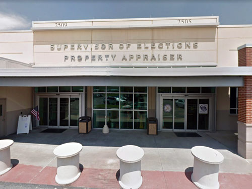 |
2505 East Irlo Bronson Memorial Hwy, Kissimmee, FL 34744 | (407)-742-5000 | |
 |
33 Avenue B, Apalachicola, FL 32320 | (850)-653-9236 | |
 |
Brevard County Property Appraiser Brevard County Government Complex - North |
400 South St., 5th Floor, Titusville, FL 32780 | (321)-264-6700 |
 |
3115-A Crawfordville Highway, Crawfordville, FL 32327 | (850)-926-0500 | |
 |
123 West Indiana Ave., Room 102, Deland, FL 32720 | (386)-736-5901 | |
 |
2300 Virginia Ave., Ft. Pierce, FL 34982 | (772)-462-1000 | |
 |
6495 Caroline St., Milton, FL 32570 | (850)-983-1880 | |
 |
301 North Olive Ave., West Palm Beach, FL 33401 | (561)-355-2866 | |
 |
(850)-651-7240 | ||
 |
915 4th Ave. West, Bradenton, FL 34206 | (941)-748-8208 | |
 |
229 SW Pinckney St, Room 201, Madison, FL 32340 | (850)-973-6133 | |
 |
(813)-272-6100 | ||
 |
207 NE 1st St., Room 108, Jasper, FL 32052 | (386)-792-2791 | |
 |
1000 Cecil G. Costin, Sr. Blvd., Room 110, Port St. Joe, FL 32456 | (850)-229-6115 | |
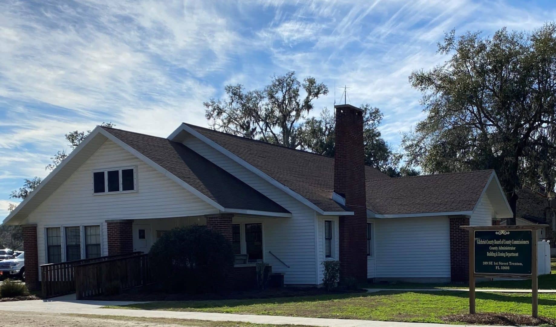 |
112 South Main St., Room 138, Trenton, FL 32693 | (352)-463-3190 | |
 |
1769 East Moody Blvd., Bunnell, FL 32110 | (386)-313-4150 | |
 |
221 Palafox Pl., 3rd Floor, Pensacola, FL 32502 | (850)-434-2735 | |
 |
214 NE 351 Hwy., Suite G, Cross City, FL 32628 | (352)-498-1212 | |
 |
477 Houston St., Green Cove Springs, FL 32043 | (904)-284-6305 | |
 |
210 North Apopka Ave., Suite 200, Inverness, FL 34450 | (352)-341-6600 | |
 |
20859 Central Ave., Room 112, Blountstown, FL 32424 | (850)-674-5636 | |
 |
860 W 11th St, Panama City, FL 32401 | (850)-248-8401 | |
 |
Pinellas County Property Appraiser Pinellas County Courthouse, |
315 Court St., Clearwater, FL 33756 | (727)-464-3207 |
 |
Miami-Dade County Property Appraiser County Government Center, Suite |
111 NW 1st St., Miami, FL 33128 | (305)-375-4712 |
 |
501 SE 25th Ave, Ocala, FL 34471 | (352)-368-8300 | |
 |
10818 NW SR 20, Bristol, FL 32321 | (850)-643-2279 | |
 |
480 West Walnut St., Monticello, FL 32345 | (850)-997-3356 | |
 |
4445 Lafayette St., Room 106, Marianna, FL 32446 | (850)-482-9646 | |
 |
226 North Waukesha St., Bonifay, FL 32425 | (850)-547-1113 | |
 |
7525 Forest Oaks Blvd, Spring Hill, FL 34606 | (352)-754-4190 | |
 |
110 West Oak St., Unit 103, Wauchula, FL 33873 | (863)-773-2196 | |
 |
16 South Calhoun St., Quincy, FL 32353 | (850)-627-7168 |
The information provided on this website about U.S. States, Counties, and Cities, is compiled from publicly available sources and is made available “as is” for informational purposes only. No representations, warranties or guarantees are made as to the accuracy, adequacy, reliability, currentness, completeness, suitability or applicability of the information contained on this website for any particular purpose. All 3rd party trademarks are for reference purposes only. PublicRecords.com powered by Intelius is a privately owned website and is not a direct source of government records or services and not affiliated with any government agency.
Compiled by: Chris E. | Reviewed by: Blake A. | Last update: 03/13/24
Florida has a variety of GIS records that are accessible to anyone. These records encompass a wide range of data allowing individuals to access and review available information online. Records can include but are not limited to, land ownership maps, property lines maps, and cadastral mapping information. We compile our resource lists from reliable government agencies to ensure ease in your search.
If you couldn't find the resource you were searching for, go to the Florida Property & Land Records page for other public records resources. Looking for something other than property and land tax records in Florida? Search the database of all public records available.
Visit our Contact Us page to report any issues.
Use the citation tool to easily create a properly formatted citation or reference. Select the format you’d like to use and copy the link from the screen below.
The information provided on this website about U.S. States, Counties, and Cities, is compiled from publicly available sources and is made available “as is” for informational purposes only. No representations, warranties or guarantees are made as to the accuracy, adequacy, reliability, currentness, completeness, suitability or applicability of the information contained on this website for any particular purpose. All 3rd party trademarks are for reference purposes only. PublicRecords.com powered by Intelius is a privately owned website and is not a direct source of government records or services and not affiliated with any government agency.
This site contains REAL public records data including criminal records, background reports, photos, court documents, address information, phone numbers, civil judgments, properties owned, social media profiles, and much more.
PublicRecords.com powered by Intelius does not provide consumer reports and is not a consumer reporting agency under the Fair Credit Reporting Act. We provide information (criminal record, address, phone number, property, civil judgment, and more) that can be used to satisfy your curiosity, protect your family, and find the truth about people in your life. To use our site you must certify below that you agree to our Privacy Policy and Terms of Use and will NOT use our site or the information we provide:


