
Conduct a GIS records search in Oklahoma using our GIS records resources.
View our GIS records resources for the state of Oklahoma. Use these GIS records to search for land ownership maps, cadastral maps, or property line maps. GIS records may contain GIS property search records, property ownership maps, and other public GIS record information.

| County | Resource | Details |
|---|---|---|
|
View Oklahoma traffic cameras including statewide map. |
||
| tulsa county |
Search City of Broken Arrow Sheriff crime maps. |
|
| tulsa county |
View City of Broken Arrow maps including City Council ward map, city limits map, and others. |
|
| tulsa county |
View City of Broken Arrow election information including voting precinct locator and precinct maps. |
|
| tulsa county |
View City of Tulsa floodplain maps. |
|
| tulsa county |
View City of Tulsa maps including downtown map, surrounding area map, floodpain maps, traffic count maps, and others. |
|
| tulsa county |
View City of Tulsa traffic cameras including map and live construction projects. |
|
| tulsa county |
View Tulsa County floodplain maps including aerial photos. |
|
| tulsa county |
View Tulsa County maps including district map, metro map, downtown Tulsa map, and others. |
|
| tulsa county |
Explore Tulsa County property values and geographic data with the interactive GIS map provided by the Tulsa County Assessor, ensuring fair market valuations as of January 1 each year. |
|
| tulsa county |
Discover accurate property valuations and explore Geographic Information System (GIS) data for Tulsa County, ensuring fair market values as of January 1 each year. |
|
| tulsa county |
Explore and download Tulsa County, OK GIS parcel data, including detailed property boundaries and associated records, directly from our Data Store. |
|
| tulsa county |
Explore property details, valuation, and tax information in Tulsa County using the official GIS mapping tool and property search database. |
|
| tulsa county |
Explore interactive maps and geospatial data of Tulsa County, OK, provided by the City of Tulsa GIS Department for public use and insights. |
|
| tulsa county |
The Tulsa County Clerk's office is the official recorder and keeper of land records and real estate documents, also serving as the chief administrative officer for the county. |
|
| tulsa county |
Get in touch with the Tulsa County Register of Deeds for property records and other real estate services. Visit the Tulsa County Clerk's office at 218 W 6th St, 7th Floor, Tulsa, OK, 74119-1004, or call 918-596-5801 for assistance. |
|
| tulsa county |
Tulsa County Register of Deeds - Official Real Estate Records |
Explore Tulsa County's official records for property transactions, including deeds, mortgages, liens, and subdivision plats in Tulsa, OK. Contact us at 918-596-5000 for assistance. |
| tulsa county |
Explore property details and ownership history with the Tulsa County Register of Deeds. Access a comprehensive database of land records maintained by Tulsa County. |
|
| tulsa county |
Tulsa County Register of Deeds - Official Records and Documents |
Explore Tulsa County's official Register of Deeds. Access property records, documents by name, date range, type, and more for informed real estate decisions. |
| garfield county |
View Garfield County wards map such as parks, precincts, transportation and more. |
|
| garfield county |
Explore Garfield County's GIS maps and property data with the County Assessor's online resources. Contact us at 580-237-0220 or visit our office at 114 W Broadway Ave, Room 106, Enid, OK 73701. |
|
| garfield county |
Explore Garfield County's GIS maps and property data with the Assessor's Parcel Search tool. Get in touch at 580-237-0220 or visit the office at 114 W Broadway Ave, Room 106, Enid, OK 73701. |
|
| garfield county |
Explore GIS and property data in Garfield County with the Assessor's online resources. Contact the Assessor at 580-237-0220 for assistance. |
|
| garfield county |
Explore Garfield County's GIS maps for property assessments. Access detailed information on parcels, valuations, and more for accurate property data. |
|
| hughes county |
Explore Hughes County, OK GIS maps, property records, and tax information with our comprehensive public records search. |
|
| hughes county |
Explore GIS mapping and public land records in Hughes County, Oklahoma, for detailed property information and geographic data. |
|
| hughes county |
Find recording services for land documents in Hughes County, OK, provided by the County Clerk, including free recording for lands owned by the Five Civilized Tribes. |
|
| hughes county |
Official site for the Hughes County Clerk/Registrar of Deeds in Oklahoma. Find contact information, office location, and services provided. |
|
| marshall county |
Search Marshall County recorded documents including property records, vital records, plat maps, and tax liens by name, date, and document type. |
|
| marshall county |
Marshall County Assessor's Office - Property Details & Tax Info - OKCounties |
The Marshall County Assessor's Office in Oklahoma provides detailed property information, including building dimensions, land area, sales history, and assessed market values, ensuring accurate property tax calculations. |
| stephens county |
Search Stephens County recorded documents including property records, plat maps, and tax liens by name, date, and document type including fees. |
|
| seminole county |
Search Seminole County recorded documents, including property records, military discharges, marriage records, divorce decrees, judgements, liens, UCC's, and plat maps. |
|
| rogers county |
Search Rogers County property tax and assessment records by name, address or account number including GIS maps. |
|
| rogers county |
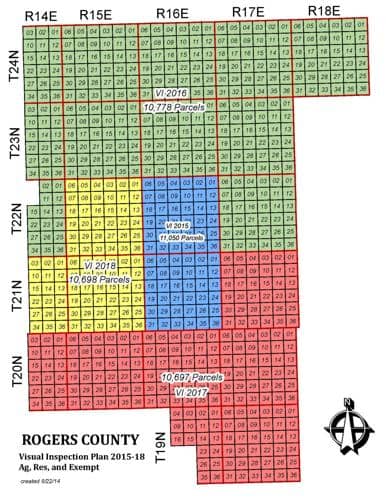
View Rogers County tax parcel maps by township and range. |
|
| rogers county |
Search Rogers County recorded documents including property records, birth records, death records, marriage records, plat maps, and tax liens by name, date, and document type. |
|
| rogers county |
View Rogers County development regulations and zoning district maps. |
|
| roger mills county |
Search Roger Mills County recorded documents including property records, military discharges, divorce decrees, judgements, liens, UCC's, and plat maps including fees. |
|
| payne county |
View City of Stillwater GIS maps including traffic count, parcel maps, zoning maps, and others. |
|
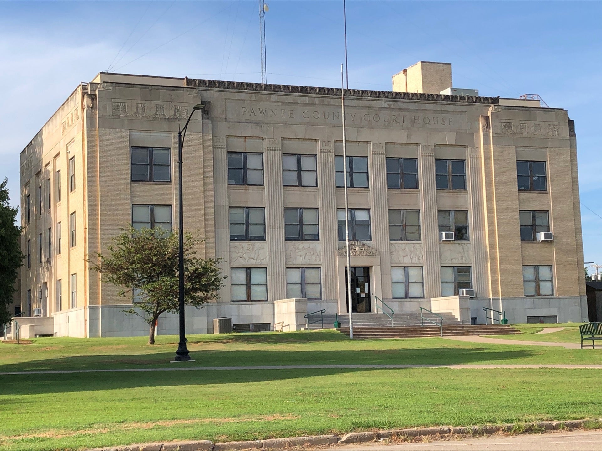
| pawnee county |
Search Pawnee County recorded documents, including property records, military discharges, divorce decrees, judgements, liens, UCC's, and plat maps including fees. |
|
| ottawa county |
Search Ottawa County recorded documents including property records, birth records, death records, plat maps, and tax liens by name, date, and document type. |
|
| oklahoma county |
View City of Midwest City floodplain management information including floodplain maps. |
|
| oklahoma county |
Search City of Midwest City library databases including genealogy resources, historic maps, consumer reports and archived newspapers. |
|
| oklahoma county |
View a map of the City of Midwest City Council wards. |
|
| oklahoma county |
Search City of Oklahoma City addresses through GIS maps by street index, intersection search and address search. |
|
| oklahoma county |
View Oklahoma County GIS maps including property information, districts, aerials, and more. |
|
| oklahoma county |
View Oklahoma County development regulations and land use plan map including registration fees. |
|
| oklahoma county |
View Oklahoma County printable snow route map. |
|
| nowata county |
Search Nowata County recorded documents including property records, death records, plat maps, and tax liens by name, date, and document type. |
|
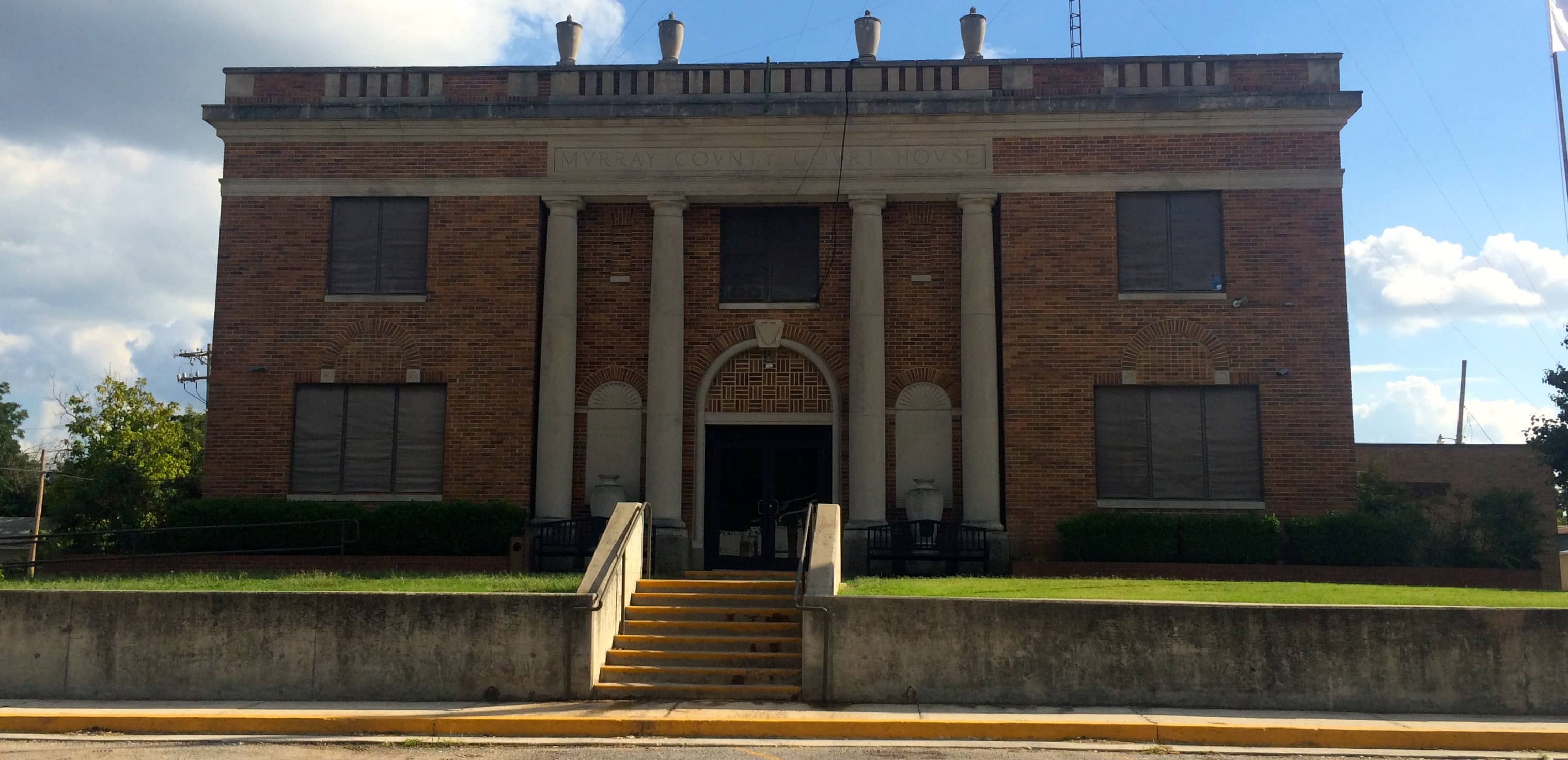
| murray county |
Search Murray County recorded documents, including property records, military discharges, divorce decrees, judgements, liens, UCC's, and plat maps. |
|
| mcclain county |
Search McClain County recorded documents, including property records, military discharges, divorce decrees, judgements, liens, UCC's, and plat maps. |
|
| mayes county |
View Mayes County Commission district maps. |
|
| logan county |
Search Logan County property tax and assessment records through GIS maps. |
|
| logan county |
Search Logan County recorded documents including property records, plat maps, and tax liens by name, date, and document type. |
|
| lincoln county |
Search Lincoln County recorded documents, including property records, military discharges, divorce decrees, judgements, liens, UCC's, and plat maps. |
|
| le flore county |
Search Le Flore County recorded documents including property records, plat maps, and tax liens by name, date, and document type. |
|
| custer county |
View Custer County maps including district maps, voting precincts map, and more. |
|
| custer county |
Search Custer County election voter registration and election information including polling locations, election results and election precinct maps. |
|
| cleveland county |
Search Cleveland County property tax and assessment records by owner name, parcel number, address or account number through GIS maps. |
|
| cleveland county |
View Cleveland County voter precincts map. |
|
| canadian county |
View Canadian County maps such as assessment maps, floodplain maps, Commissioner districts map, and more. |
|
| canadian county |
Search Canadian County plat maps using plat name, street name, developer name, city, or more. |
|
| canadian county |
View Canadian County voting precinct map. |
|
| beckham county |
View Beckham County maps including commissioner districts map, school districts map, voter precinct map and other maps. |
|
| adair county |
Search Adair County information about recorded documents, including property records, divorce decrees, liens, UCC's, and plat maps and more by name, instrument number, instrument type or date range. |
The information provided on this website about U.S. States, Counties, and Cities, is compiled from publicly available sources and is made available “as is” for informational purposes only. No representations, warranties or guarantees are made as to the accuracy, adequacy, reliability, currentness, completeness, suitability or applicability of the information contained on this website for any particular purpose. All 3rd party trademarks are for reference purposes only. PublicRecords.com powered by Intelius is a privately owned website and is not a direct source of government records or services and not affiliated with any government agency.
Below, you will find a list of offices in Oklahoma that may hold GIS maps. When requesting GIS records from these offices, it's important to be aware of any procedures, requirements, and fees associated with obtaining the records. Contacting the respective office directly will provide you with the most accurate and up-to-date information regarding access to GIS records in Oklahoma.
| Image | Office | Address | Phone |
|---|---|---|---|
 |
219 South Missouri St., Room 108, Claremore, OK 74018 | (918)-341-3290 | |
 |
200 South Lynn Riggs Blvd., Claremore, OK 74017 | (918)-923-4796 | |
 |
301 East Harrison St., Room 201, Guthrie, OK 73044 | (405)-282-0266 | |
 |
811 Manvel Ave., Suite 9, Chandler, OK 74834 | (405)-258-1264 | |
 |
101 South 11th St., Suite 301, Duncan, OK 73533 | (580)-255-0977 | |
 |
100 South Broadway St., Poteau, OK 74953 | (918)-647-5738 | |
 |
500 East Broadway St., Cheyenne, OK 73628 | (580)-497-3361 | |
 |
Adair County Courthouse 200 West Division St. Stilwell, OK 74960 | (918)-696-7198 | |
 |
110 South Wewoka Ave., Wewoka, OK 74884 | (405)-257-6236 | |
 |
500 Harrison St., Room 300, Pawnee, OK 74058 | (918)-762-2732 | |
 |
102 East Central Ave., Suite 103, Miami, OK 74354 | (918)-542-3332 | |
 |
229 North Maple St., Nowata, OK 74048 | (918)-273-0175 | |
 |
1001 West Wyandotte St., Sulphur, OK 73086 | (580)-622-3777 | |
 |
121 N. 2nd Ave., Purcell, OK 73080 | (405)-527-3360 |
The information provided on this website about U.S. States, Counties, and Cities, is compiled from publicly available sources and is made available “as is” for informational purposes only. No representations, warranties or guarantees are made as to the accuracy, adequacy, reliability, currentness, completeness, suitability or applicability of the information contained on this website for any particular purpose. All 3rd party trademarks are for reference purposes only. PublicRecords.com powered by Intelius is a privately owned website and is not a direct source of government records or services and not affiliated with any government agency.
Compiled by: Chris E. | Reviewed by: Blake A. | Last update: 03/13/24
Oklahoma has a variety of GIS records that are accessible to anyone. These records encompass a wide range of data allowing individuals to access and review available information online. Records can include but are not limited to, land ownership maps, property lines maps, and cadastral mapping information. We compile our resource lists from reliable government agencies to ensure ease in your search.
If you couldn't find the resource you were searching for, go to the Oklahoma Property & Land Records page for other public records resources. Looking for something other than property and land tax records in Oklahoma? Search the database of all public records available.
Visit our Contact Us page to report any issues.
Use the citation tool to easily create a properly formatted citation or reference. Select the format you’d like to use and copy the link from the screen below.
The information provided on this website about U.S. States, Counties, and Cities, is compiled from publicly available sources and is made available “as is” for informational purposes only. No representations, warranties or guarantees are made as to the accuracy, adequacy, reliability, currentness, completeness, suitability or applicability of the information contained on this website for any particular purpose. All 3rd party trademarks are for reference purposes only. PublicRecords.com powered by Intelius is a privately owned website and is not a direct source of government records or services and not affiliated with any government agency.
This site contains REAL public records data including criminal records, background reports, photos, court documents, address information, phone numbers, civil judgments, properties owned, social media profiles, and much more.
PublicRecords.com powered by Intelius does not provide consumer reports and is not a consumer reporting agency under the Fair Credit Reporting Act. We provide information (criminal record, address, phone number, property, civil judgment, and more) that can be used to satisfy your curiosity, protect your family, and find the truth about people in your life. To use our site you must certify below that you agree to our Privacy Policy and Terms of Use and will NOT use our site or the information we provide:


