
Conduct a GIS records search in Wisconsin using our GIS records resources.
View our GIS records resources for the state of Wisconsin. Use these GIS records to search for land ownership maps, cadastral maps, or property line maps. GIS records may contain GIS property search records, property ownership maps, and other public GIS record information.

| County | Resource | Details |
|---|---|---|
|
View Wisconsin floodplain management information including ordinances, floodplain maps, and more. |
||
|
Search for Wisconsin State legislators by street address, municipality, or district maps. |
||
|
View Wisconsin traffic cameras and alerts including live traffic information. |
||
| langlade county |
Search Langlade County property tax and assessment records through GIS maps. |
|
| langlade county |
Explore Langlade County's GIS resources including the PLSS search tool, Map of Survey, and Tie Sheet search. Access up-to-date land records and regulations effective since November 20, 2023. |
|
| langlade county |
Explore interactive maps and access property information with the Langlade County GIS Beacon service provided by Schneider Corporation. |
|
| langlade county |
Explore a comprehensive collection of Langlade County GIS maps and applications for public use, featuring local land records, regulations, and various interactive tools. |
|
| langlade county |
Langlade County WI GIS Plat Maps - Property Boundaries & Ownership |
Explore Langlade County, WI GIS plat maps for detailed property boundaries, ownership, parcel numbers, and acreage information on AcreValue. |
| langlade county |
Explore interactive maps and access detailed geographic information with the Langlade County GIS portal. Find property data, zoning, and more in Langlade County, Wisconsin. |
|
| langlade county |
Langlade County GIS Portal - Land Records & Regulations Guide |
Discover the Langlade County GIS Portal for land records and regulations. Find answers to common questions and quick solutions for navigating the GIS system. |
| langlade county |
Explore Langlade County's GIS data for property boundaries, zoning, and land use information in Antigo, WI 54409. Access maps and land records online. |
|
| shawano county |
Search Shawano County property tax and assessment records through GIS maps. |
|
| shawano county |
Shawano County WI GIS - Advanced Geographic Information Systems |
Explore the evolution of Shawano County's GIS program, initiated in 1990 by the County Board to enhance land information services. Discover the advanced GIS system now in place. |
| shawano county |
Explore the Shawano County GIS Layer Metadata V2 for detailed zoning information across participating communities. Stay informed with the latest data provided by Shawano County Government, WI. |
|
| shawano county |
Get in touch with the Shawano County Register of Deeds office for property records and other official documents. Contact Amy Dillenburg at Phone: 715-524-2129, Fax: 715-524-2130, or via email. Visit us on the 1st Floor of the Shawano County Courthouse, 311 N. |
|
| shawano county |
Get in touch with the Shawano County Register of Deeds office. Contact Amy Dillenburg at Phone: (715) 524-2129, Fax: (715) 524-2130, or visit us at the Shawano County Courthouse, 1st Floor, 311 N Main St, Shawano, WI. |
|
| shawano county |
Shawano County WI Vital Records - Register of Deeds Fee Schedule |
Obtain vital records for births, deaths, and marriages exclusively from Shawano County, WI. Contact us at 715-524-2129 for details on fees and document requests. |
| shawano county |
Obtain vital records and marriage license information from Shawano County Register of Deeds. For assistance, call the County Clerk's Office at 715-526-9150. |
|
| shawano county |
Get in touch with the Shawano County Register of Deeds office. Contact Amy Dillenburg at Phone: 715-524-2129, Fax: 715-524-2130, or visit us on the 1st Floor of the Shawano County Courthouse, 311 N Main St, Shawano, WI. |
|
| shawano county |
Explore Shawano County's GIS data, all meticulously mapped within the Shawano County Coordinate System. Official resource for local spatial information. Copyright 2024 by Shawano County Government, 311 N Main St, Shawano, WI. |
|
| shawano county |
Explore Shawano County's GIS maps and land information. Contact the GIS Coordinator, Planning & Development Director, Treasurer, or Highway Engineer for assistance. |
|
| shawano county |
Explore Shawano County with the GIS Viewer. Access detailed maps for property information, zoning, and more in Shawano County, Wisconsin. |
|
| shawano county |
Explore Shawano County's GIS maps for detailed land records, including ATV routes, cemetery locations, municipal addresses, road maps, and summer recreation areas in Wisconsin. |
|
| shawano county |
Shawano County GIS Map - Explore Property Boundaries & Ownership in WI |
Explore Shawano County, WI with our detailed GIS map. Obtain property boundaries, land ownership details, parcel numbers, and acreage data for free. |
| shawano county |
Discover detailed land information in Shawano County, WI, with GIS plat maps. Find insights on land ownership, values, and agricultural data on Tillable. |
|
| shawano county |
Explore and retrieve spatial data from Shawano County GIS Map, WI. Access various formats like CSV, KML, Zip, GeoJSON, GeoTIFF, PNG, and API links for GeoServices, WMS. |
|
| shawano county |
Explore Waupaca County's comprehensive Enterprise GIS database, featuring over 348 layers of land-related data for in-depth analysis and property ownership insights. |
|
| ozaukee county |
Search Ozaukee County property tax and assessment records through GIS maps |
|
| ozaukee county |
View Ozaukee County floodplain information and floodplain maps. |
|
| ozaukee county |
View Ozaukee County maps including topography and aerial photography. |
|
| ozaukee county |
View Ozaukee County survey section corner dossier sheets and survey maps. |
|
| ozaukee county |
Explore Ozaukee County's interactive GIS map for detailed property and land information. Access tools for basemaps, mapping, printing, and querying parcel data. |
|
| ozaukee county |
Explore and retrieve Ozaukee County GIS data in various formats including CSV, KML, Zip, GeoJSON, GeoTIFF, or PNG. Utilize API links for GeoServices, WMS, and WFS for comprehensive spatial analysis. |
|
| ozaukee county |
Get started with Ozaukee County's GIS website with our easy-to-follow guide. Find the data you need quickly and efficiently. For assistance, call (262) 284-8167 or email dlewis@co.ozaukee.wi.us. |
|
| ozaukee county |
Explore interactive maps and access detailed property information within Ozaukee County, Wisconsin, through the official GIS mapping tool. |
|
| ozaukee county |
Explore Ozaukee County's official records for real estate, birth, death, marriage, land information, and mapping services. Visit the Register of Deeds for comprehensive access. |
|
| ozaukee county |
Explore and obtain Ozaukee County real estate records through Tapestry, a service providing detailed documentation for properties in the Midwest. Applicable fees contribute to maintenance and support. |
|
| ozaukee county |
Obtain vital records in Ozaukee County, WI. Follow paper application instructions for birth, death, and marriage certificates at the Register of Deeds office, 121 W Main Street, Port Washington, WI 53074. Ensure to include the appropriate fee. |
|
| ozaukee county |
Contact the Ozaukee County Register of Deeds for property records and other official documents. Find location details, phone numbers, and email contacts. |
|
| ozaukee county |
Easily file and manage your documents with the Ozaukee County Register of Deeds electronic recording services. Streamline your paperwork online. |
|
| ozaukee county |
Explore Ozaukee County's GIS map for detailed information on floodplains, wetlands, and hydrological features in Wisconsin. |
|
| pepin county |
Search Pepin County property tax and assessment records through GIS maps by owner name, address, parcel ID and more. |
|
| pepin county |
Explore Pepin County's GIS data through the ArcGIS Hub. Download key GIS layers and access the Wisconsin Statewide Parcel Map for comprehensive land information. |
|
| pepin county |
Explore interactive maps of Pepin County, WI, with the Tax Parcel Viewer. Access property information, zoning, and more through the GIS portal. |
|
| pepin county |
Explore interactive GIS maps of Pepin County, WI, featuring detailed geographic information and various layers of interest maintained by the county. |
|
| pepin county |
Explore interactive maps and access geographic information for Pepin County, Wisconsin, on the official county GIS portal. |
|
| pepin county |
Explore Pepin County's GIS maps and property information. The Treasurer's Department provides key services under Wisconsin State Statutes Chapters 59, 70, 74, and 75. |
|
| pepin county |
Pepin County WI GIS Plat Maps - Discover Property Boundaries & Ownership |
Explore Pepin County, WI GIS plat maps for detailed property boundaries, ownership, parcel numbers, and acreage information, all available online. |
| pepin county |
Monica J. Bauer has been serving as the Pepin County Register of Deeds since January 5, 2009, bringing over 21 years of prior experience as Deputy Register of Deeds to her role. |
|
| pepin county |
Explore Pierce County's GIS Public Map Service for detailed property information, zoning, and geographical data in Pepin and surrounding areas. |
|
| pepin county |
Explore comprehensive GIS data and real estate tax details for Pepin in Pierce County, WI, by visiting the official link provided. |
|
| pepin county |
Explore interactive maps and land information for Dunn County, WI, including tax and assessment data, through our GIS portal. |
|
| pepin county |
Explore comprehensive GIS data and land records in Dunn County, WI, including detailed township information, available through the Dunn County Zoning Administrator's office. |
|
| eau claire county |
Explore interactive maps and access a wide range of geographic information for Eau Claire County through the Beacon GIS/Mapping platform. |
|
| eau claire county |
Eau Claire County GIS Division â Mapping & Geographic Data |
Explore Eau Claire County through our GIS Division's web portal. Access detailed geographic data and maps for planning, development, and public use. |
| eau claire county |
Eau Claire GIS Mapping Services | City of Eau Claire, Wisconsin |
Explore Eau Claire's official GIS maps, sourced from plats, surveys, and recorded deeds. While comprehensive, please note that these maps may reflect minor discrepancies not found in original documents. |
| eau claire county |
Explore and download a variety of GIS datasets for Eau Claire County, WI, available for public use to support mapping and analysis needs. |
|
| eau claire county |
Visit the Eau Claire County Register of Deeds at 721 Oxford Ave, Suite 1310, Eau Claire, WI 54703 for official records and documents. Call 715-839-4801 for assistance. |
|
| eau claire county |
Search Eau Claire County Sheriff crime maps by streets, terrain and labeled satellite. |
|
| eau claire county |
Eau Claire County WI GIS Property Lookup | Geographic Information Services |
Explore Eau Claire County's GIS Maps for property information, geographic data, and location services. Access the full range of GIS resources provided by the Eau Claire County Government Center. |
| eau claire county |
Explore detailed property boundaries and land ownership information in Eau Claire County, WI with our interactive GIS plat map. Discover parcel numbers, acreage, and more. |
|
| eau claire county |
Eau Claire County announces a transition in GIS mapping services. The existing WGXtreme WGX platform will be retired, making way for a new, enhanced public GIS web service. |
|
| fond du lac county |
Search Fond du Lac County property tax and assessment records through GIS maps. |
|
| fond du lac county |
View City of Fond du Lac crime maps including incident layers and dates. |
|
| fond du lac county |
Explore detailed ground features and land ownership data in Fond du Lac County, Wisconsin, with user-friendly GIS mapping tools for both the public and professionals. |
|
| fond du lac county |
Explore interactive maps and access detailed property information with the Fond du Lac County GIS portal for Wisconsin residents and businesses. |
|
| fond du lac county |
Explore Fond du Lac County's GIS parcel maps for detailed property information. Access zoning, land use, and geographic data for planning and public use. |
|
| fond du lac county |
Explore and download GIS data, create applications, and collaborate with others to address critical issues using the Fond du Lac County GIS platform. |
|
| fond du lac county |
Explore comprehensive real estate and property tax data in Fond du Lac County, Wisconsin, serving both the public and professionals with detailed GIS mapping tools. |
|
| fond du lac county |
Contact the Fond du Lac County Register of Deeds for property records and other official documents. Located at 160 S Macy St, 1st Floor, PO Box 509, Fond du Lac, WI. Call 920-929-3018 or fax 920-929-3293. Email: jimkrebs@fdlco.wi.gov. |
|
| fond du lac county |
Explore the Fond du Lac County Register of Deeds staff directory for contact information and services provided by the department in Wisconsin. |
|
| fond du lac county |
Obtain Fond du Lac County real estate forms and get guidance on whether to self-file or engage an attorney for deed registration. Access the necessary documents via the link. |
|
| fond du lac county |
Obtain vital records such as birth, death, marriage, divorce, and domestic partnership documents from the Fond du Lac County Register of Deeds Office in Wisconsin. |
|
| fond du lac county |
Explore and acquire real estate records in Fond du Lac County, Wisconsin. For detailed property information and official documents, visit the Register of Deeds. |
|
| fond du lac county |
Fond du Lac GIS Maps - Interactive City Planning & Public Works |
Explore Fond du Lac's interactive GIS maps for detailed spatial data on city planning, public works, and engineering projects in Fond du Lac, WI. |
| fond du lac county |
Explore Fond du Lac's interactive GIS maps for detailed spatial data analysis, enhancing city management and public service delivery in Wisconsin. |
|
| fond du lac county |
Explore the 2013 Fond du Lac County, WI tax parcel GIS map for detailed property and land-use information. For parcels within the City of Fond du Lac, please refer to the City's GIS resources. |
|
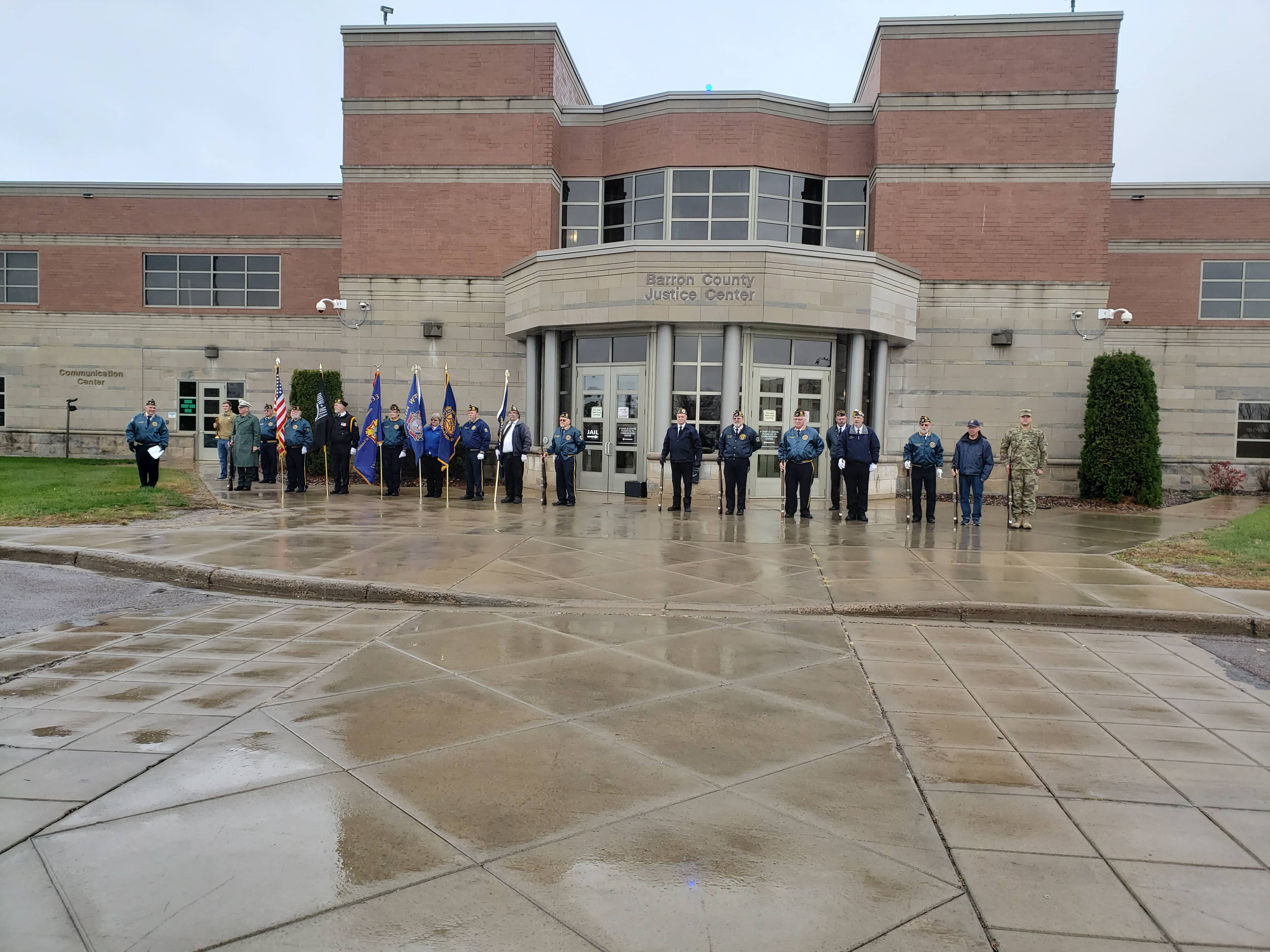
| barron county |
Search Barron County property assessment records through GIS maps by name, property address, parcel ID and more. |
|
| barron county |
View various maps of Barron County including floodplain maps, aerial photography, parks and recreation maps, and others. |
|
| barron county |
View Barron County survey records including plat maps. |
|
| barron county |
Explore Barron County's GIS data through our 24/7 online platforms, Beacon and LiDAR Online, offering detailed geographic and property information. |
|
| barron county |
Explore interactive maps and GIS data for Barron County, WI, including county facilities, supervisory districts, and more. Visit the official Barron County website for comprehensive mapping resources. |
|
| barron county |
Explore Barron County's interactive GIS maps for detailed property and land-use information, provided by Beacon. |
|
| barron county |
Explore Barron County, Wisconsin's GIS data and land records through the official web portal. Search by criteria to find property information and maps. |
|
| barron county |
Contact the Barron County Department of Land Services for GIS information. Email: landinfocobarronwius. Visit us at Government Center, 335 E Monroe Ave, Room 2104, Barron, WI 54812. |
|
| barron county |
The Barron County Register of Deeds office serves as the official county repository for real estate and vital records, ensuring their integrity and accessibility to the public. |
|
| barron county |
Barron County Register of Deeds - Vital Records & Real Estate Documents |
Obtain vital records and real estate documents from the official Barron County Register of Deeds. Access birth, death, marriage certificates, and more. |
| barron county |
Barron County WI Register of Deeds - Vital Records & Filing Information |
Explore the Barron County Register of Deeds for vital records application, including birth, marriage, death, and domestic partnership certificates, recording services, and fee schedules. |
| barron county |
Barron County Register of Deeds: Essential Community Services |
The Barron County Register of Deeds Office is essential for maintaining public records, issuing important documents, and serving the community's legal and property needs. |
| barron county |
Margo Katterhagen oversees the Barron County Register of Deeds, safeguarding real estate and vital records since 1836, ensuring the security of land titles. |
|
| barron county |
Explore Barron County, WI property information and geographic data with the official GIS portal. Search by parcel number for detailed land records. |
|
| barron county |
Explore Barron County with the new GIS website application, offering enhanced mapping tools and services to replace the retiring WGXtreme site after two decades. |
|
| barron county |
Explore Barron County's GIS services and connect with our dedicated team, including County Surveyor Catlon Phelps and GIS Specialist Rhonda Sukys. Contact us at 715-537-6375 or fax 715-537-6847. Office hours: 8 AM onwards. |
|
| barron county |
Explore a variety of Barron County GIS maps, including supervisory districts and other local features. Available in PDF format for easy access and download. |
|
| waushara county |
Search Waushara County property tax and assessment records through GIS maps. |
|
| waushara county |
View Waushara County floodplain maps by town. |
|
| waushara county |
Explore Waushara County's GIS maps for detailed property and tax data. Access a wealth of geographic information for real estate, planning, and tourism. |
|
| waushara county |
Explore Waushara County, WI GIS data and land records through our interactive web portal. Access parcel information, maps, and more with a simple click. |
|
| waushara county |
Explore Waushara County's GIS resources for detailed land records and mapping tools. Access property information, parcel data, and more. |
|
| waushara county |
Explore Waushara County's GIS map to locate properties using PIN, address, or owner's name. Easily navigate and zoom into parcels for detailed information. |
|
| waushara county |
Explore interactive GIS maps, access county codes, download forms and documents, and find answers to FAQs on the official Waushara County, WI website. |
|
| waushara county |
Contact Heather Schwersenska, Waushara County's Register of Deeds, for property records and other official documents. Visit us at 209 South Saint Marie Street, Wautoma, WI 54982 or call at 920-787-0444 for assistance. |
|
| waushara county |
Explore Waushara County's real estate records online through the Register of Deeds office. Discover property information with ease using our complimentary digital service. |
|
| waushara county |
Waushara County Register of Deeds - Official Records and Documents |
Find property records, vital records, and other important public documents at the Waushara County Register of Deeds. Visit us at 209 S Saint Marie St, Wautoma, WI 54982. |
| waushara county |
Waushara County Register of Deeds: Essential Property Records |
Discover the critical role of the Waushara County Register of Deeds (ROD) in maintaining property records, which supports local government taxation and informs ownership history. |
| waushara county |
Waushara County GIS - Real Estate & Personal Property Tax Info |
Explore Waushara County's GIS maps for detailed property and tax bill information. Access may be slow due to file sizes. |
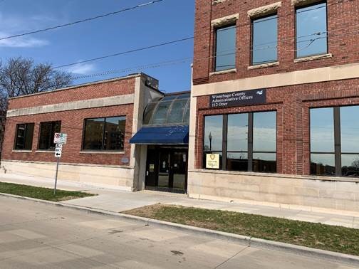
| winnebago county |
Search Winnebago County property tax and assessment records through GIS maps. |
|
| winnebago county |
View City of Oshkosh GIS maps including zoning map, storm water map, parcel viewer map and other maps. |
|
| winnebago county |
View Winnebago County supervisory district maps. |
|
| winnebago county |
Search Winnebago County real estate documents and certified survey maps through these paid services. |
|
| winnebago county |
View Winnebago County information about tax deed sales including property listings. |
|
| wood county |
Search Wood County property tax and assessment records through GIS maps. |
|
| wood county |
Search Wood County cemetery listing by name, township location and more. |
|
| wood county |
View Wood County including geodatabase, parcels, roads, tax roll, and section coordinates, floodplains and more. |
|
| wood county |
Search Wood County survey records, forms, maps including list of professional land surveyors. |
|
| waupaca county |
Search Waupaca County property tax and assessment records through GIS maps. |
|
| waukesha county |
Search the City of Waukesha property tax and assessment records through GIS maps. |
|
| washington county |
Search Washington County property tax and assessment records through GIS maps by property address, parcel ID, land range and more. |
|
| washburn county |
Search Washburn County property tax and assessment records through GIS maps. |
|
| walworth county |
Search Walworth County GIS maps by tax parcels or tax parcel ID. |
|
| vernon county |
View Vernon County public land survey (PLS) tie sheets, plat of survey maps, engineer maps for the Kickapoo Valley flood control project, PLS government plat maps, and survey records. |
|
| trempealeau county |
Search Trempealeau County property tax and assessment records including GIS maps. |
|
| taylor county |
Search Taylor County property tax and assessment records through GIS maps. |
|
| st croix county |
Search St. Croix County tax and assessments records through GIS maps by property address, parcel ID, fair market value range, acre range and more. |
|
| st croix county |
View various maps of St. Croix County, including district map, fire service map, road maps, and town zoning maps. |
|
| sheboygan county |
Search Sheboygan County property tax and assessment records through GIS maps. |
|
| sheboygan county |
View City of Sheboygan crime statistics and crime maps. |
|
| sauk county |
Search Sauk County GIS maps including parcel search. |
|
| sauk county |
View Sauk County survey records including GPS and High Accuracy Reference Network controlled stations. |
|
| rusk county |
Search Rusk County property tax and assessment records through GIS maps. |
|
| rock county |
View City of Janesville GIS maps. |
|
| rock county |
View City of Janesville voter registration and election information including ward map and polling place search. |
|
| rock county |
Search Rock County Supervisory district maps by district. |
|
| rock county |
View Rock County survey records and maps including tie sheets, corner code index map, GPS maps, and others. |
|
| rock county |
View Rock County zoning maps by town. |
|
| racine county |
Search Racine County maps including land use, environmental corridors, wetlands, soils, orthophotography, municipal and parcel boundary maps. |
|
| racine county |
Search Racine County land survey and control survey documents by location or index map. |
|
| price county |
Search Price County property tax and assessment records through GIS maps by last name, property address, land value range, acres range and more. |
|
| price county |
View Price County survey records and maps including survey records index. |
|
| price county |
View Price County timber sale maps and bid results for current and prior year. |
|
| portage county |
Search Portage County GIS maps including streets and aerial photos. |
|
| polk county |
View Polk County floodplain information including floodplain maps. |
|
| polk county |
View Polk County maps including voting, city maps, district, park and trail maps and more. |
|
| polk county |
Search Polk County recorded and non-recorded surveys and survey-related information by section, town, and range. |
|
| pierce county |
Search Pierce County GIS maps including zoning, parks, aerial photography, flood zones, and more. |
|
| outagamie county |
View City of Appleton maps including district, trail, and park maps. |
|
| outagamie county |
View Outagamie County Sheriff crime maps by crime type, date or address. |
|
| outagamie county |
Search and view various interactive GIS maps of Outagamie County, including property tax floodplain, PLSS tie sheets, crime, and foreclosure maps, as well as static street, address, supervisory districts, wards and historical maps. |
|
| outagamie county |
View Outagamie County land use maps, topography maps, historic maps and zoning maps by town, section and range. |
|
| outagamie county |
Search Outagamie County survey records and plat maps by street or date. |
|
| oneida county |
Search Oneida County property tax and assessment records through GIS maps. |
|
| oneida county |
View Oneida County survey maps, parcel maps, zoning maps and flood maps, recreation maps, school district maps and more. |
|
| oconto county |
Search Oconto County property tax and assessment records through GIS maps. |
|
| oconto county |
View Oconto County maps including election and voting maps, school district maps, and others. |
|
| oconto county |
View Oconto County polling locations by location through GIS maps. |
|
| oconto county |
View Oconto County survey corner index record through GIS maps by location. |
|
| monroe county |
Search Monroe County property tax and assessment records through GIS maps by name, address, parcel ID, fair market value and more. |
|
| milwaukee county |
View City of Milwaukee maps including neighborhood, census, demographic data, police districts, zoning and more. |
|
| milwaukee county |
View City of Milwaukee GIS maps including parcels with house numbers search. |
|
| milwaukee county |
View City of Milwaukee maps. |
|
| milwaukee county |
View the City of West Allis Police crime map by incident, date, location, address and more. |
|
| milwaukee county |
View City of West Allis GIS maps such as recycle maps, polling place maps, bicycle maps, parcel and property maps and more. |
|
| milwaukee county |
View Milwaukee County GIS maps including parcel search. |
|
| milwaukee county |
Search Milwaukee County parcel records by owner name, tax key or address including GIS maps. |
|
| marinette county |
Search Marinette County property tax and assessment records through GIS maps. |
|
| lincoln county |
View Lincoln County hiking maps, trail maps, biking maps, horse riding cross country ski trails and others. |
|
| lincoln county |
View Lincoln County ward map by towns. |
|
| lafayette county |
Search Lafayette County property records through GIS maps. |
|
| la crosse county |
View City of La Crosse Sheriff crime report maps. |
|
| la crosse county |
Search interactive GIS maps of the City of La Crosse for property address and zoning information, roads, aerial imagery, transportation, and more. |
|
| kewaunee county |
View Kewaunee County scanned right of way plats by city, township, and village. |
|
| kenosha county |
View the City of Kenosha district and ward map. |
|
| juneau county |
Search Juneau County property tax and assessment records through GIS maps. |
|
| jefferson county |
View Jefferson County GIS maps including parcel, zoning, soils, wetlands, flood hazard, and orthophoto maps. |
|
| jackson county |
Search Jackson County property tax and assessment records through GIS maps by owner name, address, parcel ID, fair marker value range, land value range and more. |
|
| jackson county |
Search Jackson County survey records such as certified survey, public land survey and more. |
|
| iowa county |
View Iowa County GIS maps by county, tax key number and address. |
|
| green lake county |
Search interactive Green Lake County GIS map for property tax and assessment records. Search by parcel number or address. |
|
| green county |
Search Green County property tax and assessment records through GIS maps. |
|
| grant county |
View Grant County GIS maps including parcel search by county, tax key number, and address. |
|
| florence county |
View Florence County GIS maps. |
|
| florence county |
View Florence County maps including recreation map, waterfall map, walking trail maps, horse trail maps and cross county ski trail maps. |
|
| dunn county |
Search Dunn County property tax and assessment records by owner, address or parcel number through GIS maps. |
|
| douglas county |
View Douglas County voting district maps. |
|
| douglas county |
View Douglas County voter and registration information including absentee ballot, district map and election results. |
|
| door county |
Search Door County property tax and assessment records through GIS maps. |
|
| dodge county |
View Dodge County voter registration and election information including absentee voting, election dates, election results, and district maps. |
|
| dane county |
Search City of Madison building permit projects through GIS map. |
|
| dane county |
View various maps of the City of Madison including Alderman district map, traffic flow maps, City map, campus maps, metro route maps and more. |
|
| dane county |
View Dane County supervisory district maps from 2012 to present. |
|
| dane county |
Search Dane County plats including subdivision, condominium, cemetery and transportation project plats including completed plat name listing. |
|
| crawford county |
Search Crawford County property tax records through GIS maps. |
|
| clark county |
Search Clark County property tax and assessment records by owner name or parcel ID including GIS maps. |
|
| calumet county |
View Calumet County Supervisors districts map. |
|
| burnett county |
Search Burnett County property tax and assessment records through GIS maps. |
|
| buffalo county |
View various maps of Buffalo County including supervisory districts map, school districts map, watershed maps, buffalo county municipalities, floodplain maps, and others. |
|
| brown county |
Search Brown County Sheriff crime maps by type of crime and date range. |
|
| brown county |
View Brown County voter register and election information including absentee voting, supervisor district maps, election results, and more. |
|
| bayfield county |
View Bayfield County GIS maps including parcel search, rural addressing, survey maps, tax ID, strip pin and more. |
|
| bayfield county |
View Bayfield County survey records including geodetic control, original field notes and other survey related topics such as control finder, survey station condition report form and more. |
|
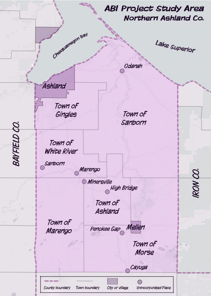
| ashland county |
Search Ashland County property assessment records through GIS maps. |
The information provided on this website about U.S. States, Counties, and Cities, is compiled from publicly available sources and is made available “as is” for informational purposes only. No representations, warranties or guarantees are made as to the accuracy, adequacy, reliability, currentness, completeness, suitability or applicability of the information contained on this website for any particular purpose. All 3rd party trademarks are for reference purposes only. PublicRecords.com powered by Intelius is a privately owned website and is not a direct source of government records or services and not affiliated with any government agency.
Below, you will find a list of offices in Wisconsin that may hold GIS maps. When requesting GIS records from these offices, it's important to be aware of any procedures, requirements, and fees associated with obtaining the records. Contacting the respective office directly will provide you with the most accurate and up-to-date information regarding access to GIS records in Wisconsin.
| Image | Office | Address | Phone |
|---|---|---|---|
 |
224 South 2nd St., Medford, WI 54451 | (715)-748-1465 | |
 |
Sheboygan County Real Property Lister Administration Building, |
508 New York Ave., Sheboygan, WI 53081 | (920)-459-3015 |
|
Sheboygan County Treasurer Sheboygan County Administration Building, Room |
508 New York Ave., Sheboygan, WI 53081 | (920)-459-3015 |
 |
740 7th Ave. West, Durand, WI 54736 | (715)-672-8850 | |
 |
301 Washington St., Oconto, WI 54153 | (920)-834-6800 | |
 |
415 Jackson St., Room 120, Oshkosh, WI 54901 | (920)-236-4777 | |
 |
Winnebago County Register of Deeds Winnebago County Courthouse, Room |
415 Jackson St., Oshkosh, WI 54901 | (414)-236-4881 |
 |
800 Wilson Avenue, Room 235, Menomonie, WI 54751 | (715)-231-6545 | |
 |
517 Court St., Room 302, Neillsville, WI 54456 | (715)-743-5155 | |
 |
Barron County Real Property Lister Barron County Government Center |
335 East Monroe Ave., Room 2104, Barron, WI 54812 | (715)-537-6313 |
 |
201 West Main St. Room 205, Ashland, WI 54806 | (715)-682-7003 | |
 |
Wood County Treasurer Department, Real Property Lister Wood County Courthouse, |
400 Market St., Wisconsin Rapid, WI 54495 | (715)-421-8484 |
 |
St. Croix County Treasurer St. Croix County Government Center |
1101 Carmichael Road, Hudson WI 54016 | (715)-386-4645 |
|
St. Croix County Treasurer St. Croix County Government Center |
1101 Carmichael Road, Hudson, WI 54016 | (715)-386-4645 |
 |
Rock County Courthouse 51 South Main St., Janesville, WI 53545 | (608)-757-5650 | |
 |
126 Cherry St., Room 108, Phillips, WI 54555 | (715)-339-2559 | |
 |
121 West Main St., Room 107, Port Washington, WI 53074 | (262)-284-8280 | |
 |
Marinette County Real Property Lister Marinette County Courthouse |
1926 Hall Ave., Marinette, WI 54143 | (715)-732-7548 |
 |
Waushara County Real Property Lister Waushara Courthouse Building |
209 S. Saint Marie St., Wautoma, WI 54982 | (920)-787-0444 |
 |
Jackson County Real Property Lister Jackson County Courthouse |
(715)-284-0203 |
The information provided on this website about U.S. States, Counties, and Cities, is compiled from publicly available sources and is made available “as is” for informational purposes only. No representations, warranties or guarantees are made as to the accuracy, adequacy, reliability, currentness, completeness, suitability or applicability of the information contained on this website for any particular purpose. All 3rd party trademarks are for reference purposes only. PublicRecords.com powered by Intelius is a privately owned website and is not a direct source of government records or services and not affiliated with any government agency.
Compiled by: Chris E. | Reviewed by: Blake A. | Last update: 03/13/24
Wisconsin has a variety of GIS records that are accessible to anyone. These records encompass a wide range of data allowing individuals to access and review available information online. Records can include but are not limited to, land ownership maps, property lines maps, and cadastral mapping information. We compile our resource lists from reliable government agencies to ensure ease in your search.
If you couldn't find the resource you were searching for, go to the Wisconsin Property & Land Records page for other public records resources. Looking for something other than property and land tax records in Wisconsin? Search the database of all public records available.
Visit our Contact Us page to report any issues.
Use the citation tool to easily create a properly formatted citation or reference. Select the format you’d like to use and copy the link from the screen below.
The information provided on this website about U.S. States, Counties, and Cities, is compiled from publicly available sources and is made available “as is” for informational purposes only. No representations, warranties or guarantees are made as to the accuracy, adequacy, reliability, currentness, completeness, suitability or applicability of the information contained on this website for any particular purpose. All 3rd party trademarks are for reference purposes only. PublicRecords.com powered by Intelius is a privately owned website and is not a direct source of government records or services and not affiliated with any government agency.
This site contains REAL public records data including criminal records, background reports, photos, court documents, address information, phone numbers, civil judgments, properties owned, social media profiles, and much more.
PublicRecords.com powered by Intelius does not provide consumer reports and is not a consumer reporting agency under the Fair Credit Reporting Act. We provide information (criminal record, address, phone number, property, civil judgment, and more) that can be used to satisfy your curiosity, protect your family, and find the truth about people in your life. To use our site you must certify below that you agree to our Privacy Policy and Terms of Use and will NOT use our site or the information we provide:


