
Conduct a GIS records search in Delaware using our GIS records resources.
View our GIS records resources for the state of Delaware. Use these GIS records to search for land ownership maps, cadastral maps, or property line maps. GIS records may contain GIS property search records, property ownership maps, and other public GIS record information.

| County | Resource | Details |
|---|---|---|
|
View an interactive map of Delaware police department expenditures. |
||
|
View maps of Delaware election districts. |
||
|
Search for available Delaware public archive records by name, keyword, or list by collection. Collection includes death registers, maps, naturalizations, newspapers, and probates. |
||
|
Search interactive Delaware environmental GIS maps. |
||
|
View an interactive map of Delaware police department expenditures. |
||
| sussex county |
Search Sussex County property tax records by owner name, parcel number, billing address, or property description including map search. |
|
| sussex county |
View current Sussex County council district maps. |
|
| new castle county |
Search interactive GIS map of New Castle County by parcel ID, address, or owner name. Map includes zoning and parcel data, tax and assessment information, project plans, permit history, sales history, census tracts, political districts, infrastructure, natural features, and aerial photos. |
|
| new castle county |
View New Castle County voter registration and election information including election results from 1996 to present, current polling locations, official redistricting maps, absentee voting, and upcoming elections. |
|
| new castle county |
Search New Castle County crime incident map by address. |
|
| kent county |
View Kent County voter registration and election information including election results from 2005 to present, current polling locations, official redistricting maps, absentee voting, and upcoming elections. |
|
| kent county |
Search interactive Kent County GIS map for parcel zoning, acreage, building permits, property location, building type, year built, land use application information, and more. |
The information provided on this website about U.S. States, Counties, and Cities, is compiled from publicly available sources and is made available “as is” for informational purposes only. No representations, warranties or guarantees are made as to the accuracy, adequacy, reliability, currentness, completeness, suitability or applicability of the information contained on this website for any particular purpose. All 3rd party trademarks are for reference purposes only. PublicRecords.com powered by Intelius is a privately owned website and is not a direct source of government records or services and not affiliated with any government agency.
Below, you will find a list of offices in Delaware that may hold GIS maps. When requesting GIS records from these offices, it's important to be aware of any procedures, requirements, and fees associated with obtaining the records. Contacting the respective office directly will provide you with the most accurate and up-to-date information regarding access to GIS records in Delaware.
| Image | Office | Address | Phone |
|---|---|---|---|
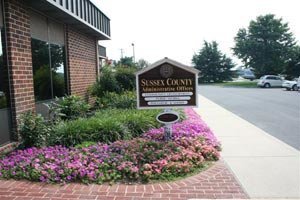 |
Sussex County Assessment Office Sussex County Administrative Office Bldg., Rooms |
2 The Circle, P.O. Box 589, Georgetown, DE 19947 | (302)-855-7824 |
The information provided on this website about U.S. States, Counties, and Cities, is compiled from publicly available sources and is made available “as is” for informational purposes only. No representations, warranties or guarantees are made as to the accuracy, adequacy, reliability, currentness, completeness, suitability or applicability of the information contained on this website for any particular purpose. All 3rd party trademarks are for reference purposes only. PublicRecords.com powered by Intelius is a privately owned website and is not a direct source of government records or services and not affiliated with any government agency.
Compiled by: Chris E. | Reviewed by: Blake A. | Last update: 03/13/24
Delaware has a variety of GIS records that are accessible to anyone. These records encompass a wide range of data allowing individuals to access and review available information online. Records can include but are not limited to, land ownership maps, property lines maps, and cadastral mapping information. We compile our resource lists from reliable government agencies to ensure ease in your search.
If you couldn't find the resource you were searching for, go to the Delaware Property & Land Records page for other public records resources. Looking for something other than property and land tax records in Delaware? Search the database of all public records available.
Visit our Contact Us page to report any issues.
Use the citation tool to easily create a properly formatted citation or reference. Select the format you’d like to use and copy the link from the screen below.
The information provided on this website about U.S. States, Counties, and Cities, is compiled from publicly available sources and is made available “as is” for informational purposes only. No representations, warranties or guarantees are made as to the accuracy, adequacy, reliability, currentness, completeness, suitability or applicability of the information contained on this website for any particular purpose. All 3rd party trademarks are for reference purposes only. PublicRecords.com powered by Intelius is a privately owned website and is not a direct source of government records or services and not affiliated with any government agency.
This site contains REAL public records data including criminal records, background reports, photos, court documents, address information, phone numbers, civil judgments, properties owned, social media profiles, and much more.
PublicRecords.com powered by Intelius does not provide consumer reports and is not a consumer reporting agency under the Fair Credit Reporting Act. We provide information (criminal record, address, phone number, property, civil judgment, and more) that can be used to satisfy your curiosity, protect your family, and find the truth about people in your life. To use our site you must certify below that you agree to our Privacy Policy and Terms of Use and will NOT use our site or the information we provide:


