
Conduct a GIS records search in Michigan using our GIS records resources.
View our GIS records resources for the state of Michigan. Use these GIS records to search for land ownership maps, cadastral maps, or property line maps. GIS records may contain GIS property search records, property ownership maps, and other public GIS record information.

| County | Resource | Details |
|---|---|---|
|
View Michigan State Climatologist's Office map of Michigan historical climatological summary tables, climate watch maps for 7, 30 and 90 days, precipitation data, and real-time weather data. |
||
|
View Michigan Department of Environmental Quality information about environmental services and programs including air permits, air quality forecast, environmental mapper, oil and gas database, hazardous waste, wetlands, and more. |
||
|
View Michigan Department of Natural Resources maps such as hunting, geology, hydrology, topographic and aerial. Users can find a Deer Check station, shooting range, trout fishing destinations, forest roads, state forests, and more. |
||
|
View Michigan Real Estate Services surplus real property sales by property name including photos and maps. Users can also access links to property sales by specific state departments including Michigan Department of Transportation, Department of Natural Resources, and Department of Treasury. |
||
|
Search State of Michigan Bureau of Land Management subdivision plat images, surveys, land status records, tract book records, and related documents by county. |
||
|
View Michigan GIS maps by address, community or points of interest. |
||
| menominee county |
Search State of Michigan Bureau of Land Management subdivision plat images, surveys, land status records, tract book records, and related documents by county. |
|
| menominee county |
Menominee County GIS Services - Interactive Maps & Information |
Explore interactive maps and access a wealth of geographic information with Menominee County's GIS services. Office hours: Mon-Fri, 8:00 AM - 4:30 PM. |
| menominee county |
Explore Menominee County's GIS portal for detailed land information. Utilize tools to search by parcel, view on-screen attributes, and extract key property data. |
|
| menominee county |
Get in touch with Menominee County's GIS department for land information services. Contact Kandace Curran, Equalization Director, at 906-863-2683 or visit the County Courthouse at 839 10th Avenue, Menominee, MI 49858. Find location details and office hours on our contact page. |
|
| menominee county |
Discover comprehensive land parcel data in Menominee County, MI. Explore detailed property boundaries and US-wide land parcel coverage on our interactive map. |
|
| menominee county |
Explore interactive maps and access a wealth of geographic information with Menominee County's GIS Land Information Services. Find local data for Cedarville Township, the City of Menominee, and more. |
|
| roscommon county |
Explore the official repository for all real estate document filings in Roscommon County, MI, where the Register of Deeds maintains records as mandated by state law. |
|
| roscommon county |
Contact the Roscommon County Register of Deeds for property records and deeds. Find location details, phone, and fax numbers for assistance. |
|
| roscommon county |
Visit the Roscommon County Register of Deeds for information on deed copies, office hours, and more. Open weekdays, 8:30 AM - 4:30 PM, with a fee of $1.00 per page for deed prints. |
|
| roscommon county |
Roscommon County Register of Deeds - Property Records & Online Services |
Explore property records and access a variety of online services provided by the Roscommon County Register of Deeds in Michigan. Stay informed with the latest public notices. |
| roscommon county |
Ensure your documents meet the necessary criteria for recording with the Roscommon County Register of Deeds. Original signatures and clearly typed names are mandatory. |
|
| roscommon county |
Contact the Roscommon Register of Deeds in Michigan for property records and deeds. Located at 500 Lake St, Roscommon, MI 48653. Call 989-275-5931 or fax 989-275-8640 for assistance. |
|
| roscommon county |
Search the Roscommon Register of Deeds in Michigan for property records by name, document type, or document number to find Grantor/Grantee information. |
|
| roscommon county |
Find Roscommon County Register of Deeds information, including location, office hours, and services provided for recording documents in Roscommon, MI. |
|
| roscommon county |
Explore detailed property maps, zoning information, and geographical data in Roscommon County, Michigan with the GIS web application. |
|
| roscommon county |
Explore a variety of GIS maps of Roscommon County, MI, available for public download and use in planning, navigation, and analysis. |
|
| roscommon county |
Explore Roscommon County's GIS services for address issuance, economic development, and online map services. Contact Brittany Baker for assistance. |
|
| roscommon county |
Explore detailed GIS parcel data for Roscommon County, Michigan, including property boundaries, ownership, and more for informed decision-making. |
|
| roscommon county |
Explore and download detailed parcel data for Roscommon County, MI. Access GIS layers and associated records for comprehensive land analysis. |
|
| roscommon county |
Explore Gladwin County's official records for property taxes, deeds, and assessments. Access detailed information for real estate and property in Gladwin, Michigan. |
|
| newaygo county |
Search for property and zoning information though Newaygo County GIS maps. |
|
| newaygo county |
Search Newaygo County tax parcels by owner name, address or parcel id including GIS maps. |
|
| newaygo county |
Explore Newaygo County, MI with our interactive GIS map. While the map provides a visual reference, for precise details and official use, please consult the original sources. |
|
| newaygo county |
Explore interactive maps of Newaygo County, Michigan, for detailed property and land information. Access parcel data, zoning, and more with the official GIS map service. |
|
| newaygo county |
Explore detailed property boundaries and land ownership information with the Newaygo County GIS map for Michigan. Access parcel numbers, acreage data, and more. |
|
| newaygo county |
Discover comprehensive land parcel data in Newaygo County, MI. Explore property boundaries and detailed information with our complete GIS mapping coverage. |
|
| newaygo county |
Explore Newaygo County, MI with our interactive GIS map to search for parcel information, property lines, and geographic data. |
|
| newaygo county |
Newaygo County Register of Deeds - Document Recording Services |
Ensure your documents are properly recorded by mailing them to the Newaygo County Register of Deeds at PO Box 885, White Cloud, MI 49349. Include a self-addressed stamped envelope for convenience. |
| newaygo county |
Explore Newaygo County's Register of Deeds for document searches in White Cloud, MI. Open Mon-Fri, 8 AM - 5 PM. Call 231-689-7246 or 231-689-7271 for assistance. |
|
| newaygo county |
The Newaygo County Register of Deeds Office records and maintains documents related to real estate such as deeds, mortgages, and other property records for public access. |
|
| newaygo county |
Explore and access land records and property information in Newaygo County, Michigan through the official Register of Deeds online portal. |
|
| newaygo county |
Visit the Newaygo County Register of Deeds for document recording services. Located at 1087 Newell St, PO Box 885, White Cloud, MI 49349. Open Mon-Fri, 8 AM - 5 PM. Call 231-689-7246 or 231-689-7271 for assistance. |
|
| newaygo county |
Search for Newaygo County public records, including property and court records, through the official Register of Deeds. Contact: (231) 689-7246. |
|
| newaygo county |
Find contact information for the Newaygo Register of Deeds office in Michigan, including address, phone, fax, and email for property records and transactions. |
|
| kalamazoo county |
View City of Kalamazoo voter and election information including precinct locations, election results and precinct maps. |
|
| kalamazoo county |
View City of Kalamazoo Public Safety daily calls for service through GIS maps. |
|
| kalamazoo county |
The Kalamazoo County Register of Deeds is responsible for the preservation and management of public land records, ensuring the accurate recording and indexing of documents in Michigan. |
|
| kalamazoo county |
The Kalamazoo County Clerk/Register of Deeds office provides vital services, including document recording and maintaining records. Contact us at 269-383-8840 for Clerk inquiries and 269-383-8970 for Deeds assistance. |
|
| kalamazoo county |
Kalamazoo County Clerk/Register of Deeds Contact Information |
Get in touch with the Kalamazoo County Clerk/Register of Deeds office. Contact John Curran, Chief Deputy Clerk/Register of Deeds, via email or visit us at 201 West Kalamazoo Avenue, Kalamazoo, MI. |
| kalamazoo county |
Explore the latest GIS online mapping tools for Kalamazoo County. Access a wealth of geographic information with the new ArcGIS Online application for efficient planning and analysis. |
|
| kalamazoo county |
Explore Kalamazoo County's interactive GIS map for detailed property and land use information, including parcel boundaries, zoning, and environmental data. |
|
| kalamazoo county |
Explore Kalamazoo County's interactive GIS map for detailed property and land-use information, provided by various authoritative sources including Esri, USGS, and NASA. |
|
| kalamazoo county |
Explore Kalamazoo County's GIS maps to find detailed property information, zoning, land use, natural features, and more. Stay informed with the latest collection dates and updates. |
|
| kalamazoo county |
Kalamazoo County GIS Parcel Viewer - Detailed Property Insights |
Explore detailed parcel data for Kalamazoo County (excluding the City of Kalamazoo and the City of Portage) with our comprehensive GIS mapping tool. |
| mackinac county |
Mackinac County, MI, collaborates with the Eastern UP Regional Planning & Development office to enhance its Geographic Information Systems (GIS) capabilities for improved planning and development. |
|
| mackinac county |
Explore GIS data and property information in Mackinac County, MI, provided by the Equalization Department for accurate property assessments. |
|
| mackinac county |
Explore Mackinac County's GIS maps, access marriage licenses, passports, plat books, and more through the Register of Deeds' comprehensive online index. |
|
| mackinac county |
Explore Mackinac County's GIS resources for detailed property and land use data. For financial insights, visit Michigan's Community Financial Dashboard. |
|
| mackinac county |
Explore Mackinac County, MI with our detailed GIS plat map. Discover property boundaries, land ownership details, parcel numbers, and acreage data for free. |
|
| mackinac county |
Mackinac County Register of Deeds - Official Property Records |
Explore Mackinac County's official records for property ownership, including deeds, plats, mortgages, and security instruments in Michigan. |
| mackinac county |
Find answers to common questions about document recording options, including mail, courier services, and eRecording at the Mackinac County Register of Deeds. Visit us at 100 S Marley St, St Ignace, MI 49781 or call 906-. |
|
| mackinac county |
Explore Mackinac County's Register of Deeds for real estate record search fees, including state and federal tax lien certificate costs. Minimum fees apply. |
|
| mackinac county |
Ensure compliance with Mackinac County's Register of Deeds by following the official recording requirements. Original signatures and clearly printed names are mandatory for document validity. |
|
| mackinac county |
Discover comprehensive land parcel data in Mackinac County, MI. Explore our complete map with detailed property boundaries and essential information for each parcel. |
|
| mackinac county |
Explore Mackinac County GIS maps and access a wide range of public records, property tax information, and assessor data in Michigan. |
|
| wexford county |
Contact the Wexford County Register of Deeds for property records and deeds. Reach out to Roxanne Snyder at 437 E Division St, Cadillac, MI 49601 or call 231-779-9455. |
|
| wexford county |
Find answers to frequently asked questions about the Wexford County Register of Deeds, including availability of forms for various property deeds and liens, as well as associated fees. |
|
| wexford county |
Visit the Wexford County Register of Deeds in Michigan during our office hours, Monday to Friday, 8:30 AM to 5:00 PM. Vault access is available until 4:30 PM. Note that we are closed on designated holidays. |
|
| wexford county |
Obtain property records easily with Wexford County Register of Deeds. Affordable search and copy fees, with fax services for document requests. |
|
| wexford county |
Record your documents in Wexford County, MI with a flat fee of $30, covering all pages, Michigan Remonumentation, and Register of Deeds Automation fees. |
|
| wexford county |
Explore Wexford County, MI with our interactive GIS maps. Utilize advanced tools for parcel searches by name, number, or address, and measure distances and areas with ease. |
|
| wexford county |
Discover how GIS technology enhances public safety, E911, emergency management, and land information services in Wexford County, Michigan. |
|
| wexford county |
Explore Wexford County's GIS services for detailed property information, including names, addresses, and parcel numbers. Access the MI Community Financial Dashboard for local financial data. |
|
| wexford county |
Discover comprehensive land parcel data in Wexford County, MI. Explore property boundaries and detailed information with our complete GIS mapping coverage. |
|
| wexford county |
Discover detailed Wexford County, MI parcel maps with comprehensive land ownership and property line information, including parcel boundaries and acreage, provided by Rockford Map. |
|
| wexford county |
Wexford County MI GIS | Land Value & Property Classification |
Explore Wexford County, MI's geographic information system (GIS) for detailed land value assessments and property classification data updated annually. |
| wexford county |
Understanding GIS in Wexford County, MI | Geographic Data & Mapping |
Discover how GIS integrates and visualizes geographic data like roads, rivers, parcel boundaries, and aerial imagery, providing layered mapping and analysis for Wexford County, Michigan. |
| lapeer county |
View Lapeer County information about purchasing GIS maps. |
|
| lapeer county |
Lapeer County Register of Deeds - Real Estate Records & Services |
Discover public records and services related to real estate in Lapeer County, MI. Efficient processing and accessibility of property documents. |
| lapeer county |
Find the latest recording requirements and fees for document entry in Lapeer County, MI, as per MCL 600.2567(1)(a). |
|
| lapeer county |
Contact the Lapeer County Register of Deeds for property records and deeds. Located at 287 W Nepessing St., Suite 1, Lapeer, MI 48446. Call 810-667-0211 or fax 810-667-0293 for assistance. |
|
| lapeer county |
Find property records, vital records, and deed information from the Lapeer County Register of Deeds in Michigan for legal documentation and public inquiries. |
|
| lapeer county |
Discover property records, recording fees, and other vital information for real estate located in Lapeer County, Michigan, through the Register of Deeds office. |
|
| lapeer county |
Explore Lapeer County's official records online, including property taxes, deeds, and assessor information in Michigan with ease. |
|
| lapeer county |
Explore Lapeer County's GIS resources, including section maps, orthophotos, aerials, and digital files, provided by the Treasurer's Office for public access and use. |
|
| lapeer county |
Explore Lapeer County, MI through our Geographic Information System (GIS). Access detailed property data, maps, and the City Assessor's records for comprehensive insights. |
|
| lapeer county |
Explore comprehensive GIS mapping data for Lapeer County, including flood hazards, parcel information, and regulatory flood determinations from the MI Department of Transportation. |
|
| lapeer county |
Explore comprehensive agricultural insights with Lapeer County, MI GIS maps, featuring farmland values, soil productivity, crop distribution, and detailed parcel ownership information. |
|
| lapeer county |
Explore the Lapeer County Register of Deeds for property records, deed information, and official public documents in Lapeer County, Michigan. |
|
| lapeer county |
Lapeer County GIS Map - Explore Property Boundaries & Ownership in MI |
Explore detailed property boundaries and land ownership information in Lapeer County, MI with our interactive GIS map. Access parcel numbers, acreage data, and more. |
| antrim county |
Explore Antrim County's Register of Deeds for a comprehensive index and copies of documents related to real estate within the county boundaries in Michigan. |
|
| antrim county |
Explore Antrim County's Register of Deeds public search options for property records and other official documents. For assistance, call the office at 231-533-6683. |
|
| antrim county |
View the Antrim County Register of Deeds fee schedule for certified copies and recording services. Payment methods include checks, cash, or credit cards. |
|
| antrim county |
Discover the necessary documentation for recording with the Antrim County Register of Deeds. Find office hours and location for in-person visits in Bellaire, MI. |
|
| antrim county |
Contact the Antrim County Register of Deeds for property records and deeds in Bellaire, MI. Find office location, PO Box, and phone details for efficient document handling. |
|
| antrim county |
Explore Antrim County, MI with the GIS map tool, providing detailed geographic data, property boundaries, and more for effective analysis and planning. |
|
| antrim county |
Explore Antrim County's GIS map for the latest parcel data. While updates are frequent, for the most current parcel information, please refer to the Antrim County Parcel. |
|
| antrim county |
Antrim County GIS provides maps and spatial data services to the public, nonprofit organizations, and county departments. Learn about our geographic data fees. |
|
| antrim county |
Explore Antrim County's GIS map for detailed property information, including sales data, parcel maps, property descriptions, and current assessments for equalization purposes. |
|
| antrim county |
Antrim County Recorder of Deeds - Document Fees & Guidelines |
Find Antrim County recording fees and document submission guidelines. All documents are recorded for a flat fee, including Michigan Remonumentation and Register services. |
| antrim county |
Explore Antrim County's official records and connect with the Register of Deeds for property and legal documentation. Contact: 231-533-6683. |
|
| antrim county |
Explore Alcona County's official records for property taxes, deeds, and assessments. Access detailed information for Antrim and other regions in Michigan. |
|
| antrim county |
The Lake County Register of Deeds office in Michigan is dedicated to offering top-notch services to the community, ensuring trust and reliability in public record management. |
|
| antrim county |
Discover comprehensive land parcel data in Antrim County, MI. Explore our complete map with detailed property boundaries and US-wide county information. |
|
| antrim county |
The Grand Traverse County Register of Deeds Office is the authoritative source for land records and documentation in Antrim and Grand Traverse County, Michigan. |
|
| antrim county |
Antrim Register of Deeds - Grand Traverse County, MI - Free Online Document Search |
Explore the Grand Traverse County Register of Deeds Office's online database for free. Access land records and documents dating back to 1969 with limited information available. |
| antrim county |
Explore Grand Traverse County's Interactive GIS Map Gallery, including the Parcel Tax Data Viewer with the latest updates from the December 2023 Board of Review. Discover comprehensive tax parcel maps and more. |
|
| antrim county |
Explore detailed GIS maps of Antrim and Grand Traverse County, MI, offering precise spatial data for various applications in Traverse City. |
|
| antrim county |
Antrim Grand Traverse County Register of Deeds - Official Records Search |
Explore and obtain official records from the Antrim Grand Traverse County Register of Deeds in Michigan. Fees apply for document search, viewing, and printing services. |
| sanilac county |
Explore Sanilac County's GIS Parcel Data for detailed property information. Access maps, pricing, and download options for comprehensive land analysis. |
|
| sanilac county |
Explore interactive maps and property information in Sanilac County, Michigan with the official GIS mapping tool. |
|
| sanilac county |
Explore Sanilac County's GIS portal for detailed parcel information, downloadable GIS data, and comprehensive map pricing. Stay informed with the latest updates. |
|
| sanilac county |
Explore GIS parcel data and maps for Sanilac County, MI. Access the GISParcel Fetch System for detailed property information and county spatial analysis tools. |
|
| sanilac county |
Explore the Sanilac County MI GIS Parcel Fetch System with our tutorial video. Access property information and maps at the Sanilac County Courthouse, 60 W Sanilac Ave, Sandusky, MI 48471. |
|
| alpena county |
View Alpena County GIS maps by geographic extent, theme and metadata search. |
|
| alpena county |
Visit the Alpena County Register of Deeds Office in Michigan for recording and maintaining records of all land transactions, including deeds, mortgages, liens, and land contracts. |
|
| alpena county |
Alpena County Register of Deeds - Official Records and Services |
Find contact information and official records at the Alpena County Register of Deeds in Michigan for property and deed registration services. |
| alpena county |
Contact the Alpena County Register of Deeds for property records and deeds. Find location, contact details, and services offered. |
|
| alpena county |
Alpena County Register of Deeds | Alpena County, MI Official Services |
Explore services from the Alpena County Register of Deeds, including property records and land deeds. Find job openings, building maps, and home improvement programs in Alpena County, MI. |
| alpena county |
Alpena County Register of Deeds - Michigan Real Estate Records |
Discover comprehensive details on real estate deed recording in Alpena County, Michigan. Find contact information for the recorder's office and local elected officials. |
| alpena county |
Explore GIS data, property assessments, and taxable values in Alpena County, MI. Contact the Equalization Office at 989-354-9500 or fax 989-354-9648 for assistance. |
|
| alpena county |
Explore comprehensive land parcel data within Alpena County, MI, featuring full property boundaries and essential details for each parcel on an interactive map. |
|
| alpena county |
Explore Alpena County's GIS for property tax information, access bids, proposals, and connect with the Building Department at First Avenue, Alpena, MI 49707. Office hours are Mon-Fri, 8am-5pm. Call us at 989-354-1700. |
|
| alpena county |
Explore interactive GIS maps and property information in Alpena County, MI, with our user-friendly online portal, powered by BSA Software. |
|
| alpena county |
Oscoda County Interactive GIS Map - Alpena, MI | The Schneider Corporation |
Explore Oscoda County's interactive GIS map for detailed property information, geographic data, and mapping tools in Alpena, MI, provided by The Schneider Corporation. |
| alpena county |
Explore comprehensive agricultural insights with the Oscoda County, MI GIS map, featuring detailed farmland values, soil productivity, crop distribution, and ownership information. |
|
| alpena county |
The Equalization Department supports local assessors in Alpena and Oscoda County, MI, with property identification, listing, and fair valuation for taxation, enhancing GIS data usage for accuracy. |
|
| alpena county |
Explore detailed property boundaries and land ownership information for Alpena Oscoda County, MI with our interactive GIS plat map. |
|
| arenac county |
Explore Arenac County's GIS maps powered by Earthstar Geographics with data from USGS, Esri, HERE, and Garmin for detailed property and hydrography information. |
|
| arenac county |
Explore Arenac County's GIS maps for detailed information on cities, villages, townships, and county agencies. Discover local economic development and contact Animal Control at 989-846-4421, located at Grove St, PO Box 747, Standish, MI 48658. |
|
| arenac county |
Explore interactive GIS maps of Arenac County, MI, featuring detailed information on cities, villages, townships, county agencies, and economic development. Contact details: Grove St, PO Box 747, Standish, MI 48658, Animal Control: 989-846-4421. |
|
| arenac county |
Discover comprehensive land parcel data in Arenac County, MI. Explore our complete map with detailed property boundaries and county-wide geographic information. |
|
| arenac county |
Arenac County, MI Agricultural Data - Farmland Values & Soil Survey GIS Map |
Explore comprehensive agricultural insights with Arenac County, MI GIS map, featuring detailed farmland values, soil productivity, crop distribution, and ownership information. |
| arenac county |
Arenac County Register of Deeds - Official Records & Information |
Explore Arenac County's Register of Deeds for online records dating from February 11, 1991, to the present, including Michigan recording requirements and real estate transfer tax exemptions. |
| arenac county |
Explore Arenac County's Register of Deeds services for property records, and utilize convenient online payment options for taxes and fees. |
|
| arenac county |
Find property records and other important public documents at the Arenac County Register of Deeds. Contact us at 989-846-9201 or visit us at 120 N Grove St, P.O. Box 296, Standish, MI. |
|
| arenac county |
Contact the Arenac County Register of Deeds for property records at 989-846-9201. Explore additional services including Treasurer's Office, Veterans Affairs, and online resources. |
|
| arenac county |
Contact the Arenac County Register of Deeds for property records and deeds. Located at 120 N Grove St, PO Box 296, Standish, MI 48658. Phone: 989-846-9201, Fax: 989-... |
|
| arenac county |
Arenac County GIS Mapping - Michigan Association of Counties |
Explore detailed GIS maps for Arenac County and other Michigan counties, provided by the Michigan Association of Counties. Access geographic data and mapping services for local insights. |
| marquette county |
View Marquette County GIS maps including tax parcel maps. |
|
| marquette county |
Explore Marquette County's Register of Deeds online for document searches. Multiple search options available, including a fee-based service for comprehensive access. |
|
| marquette county |
Explore Marquette County's Register of Deeds services including online document searches, fee schedules, and recording requirements. Find all the official information you need for property records in Marquette County, MI. |
|
| marquette county |
Explore Marquette County's official records for property taxes, deeds, and assessments in Michigan. Access documents easily with online searches. |
|
| marquette county |
Explore Marquette County's Register of Deeds for online document searches, probate fee schedules, guardianship records, and more. Conveniently order records online through the Official Records Online portal. |
|
| marquette county |
Explore Michigan's official Public Sex Offender Registry (PSOR) for information on registered sex offenders in Marquette, ensuring community safety and awareness. |
|
| marquette county |
Discover up-to-date information on registered sex offenders residing in Marquette, MI, with data reflecting 49 individuals as of February 03, 2024. |
|
| marquette county |
Marquette, MI Sex Offender Registry | Public Safety Resource |
Explore the Michigan Sex Offender Registry to enhance public safety by locating and identifying sex offenders in Marquette and across Michigan. |
| marquette county |
Explore the latest data on registered sex offenders residing in Marquette, MI, zip code 49855, ensuring community safety and awareness. |
|
| marquette county |
Utilize the Michigan Sex Offender Registry to conduct searches and enhance public safety by staying informed about sex offenders in Marquette, MI. |
|
| iosco county |
View Iosco County maps including topographical maps. |
|
| iosco county |
View Iosco County GIS maps. |
|
| iosco county |
The official source for recording and safeguarding real estate documents in Iosco County, including deeds, mortgages, and more. |
|
| iosco county |
Find guidelines for documents that convey or encumber real estate in Michigan at the Iosco County Register of Deeds. Visit us at 422 W Lake St, Tawas City. |
|
| iosco county |
Find answers to common questions about document recording, fees, and requirements at the Iosco County Register of Deeds. Contact us at 989-362-2021 for assistance. |
|
| iosco county |
Find property records and other important public documents at the Iosco County Register of Deeds. Visit us in Tawas City, MI or access resources online. |
|
| iosco county |
Explore Iosco County's GIS property search for up-to-date assessing records, current and delinquent property tax information, and probate/family case records through our convenient online services. |
|
| iosco county |
Explore Iosco County's GIS maps for detailed property information, including assessing records, current and delinquent tax data, and land surveys available online. |
|
| iosco county |
Explore IOSCO County's GIS property search for detailed maps and information on all-season routes, certified county roads, and more. Get in touch with the IOSCO County Road Commission for assistance. |
|
| iosco county |
Explore and download detailed GIS property maps and records for Iosco County, MI. Access up-to-date parcel data, administrative boundaries, and more. |
|
| iosco county |
Explore property details, tax records, and geographical information in Iosco County, MI with our comprehensive GIS property search tool. |
|
| iosco county |
Explore Iosco County's GIS services for detailed property information, mapping, and spatial data analysis in Michigan. |
|
| washtenaw county |
View Washtenaw County Sheriff crime maps. |
|
| washtenaw county |
Washtenaw County Register of Deeds | Official Property Records MI |
Explore Washtenaw County's official records for property and land transactions. The Register of Deeds Office is your trusted source for real estate document preservation in Washtenaw County, Michigan. |
| washtenaw county |
Washtenaw County Clerk/Register of Deeds - Michigan Official Records |
Official source for vital records, land documentation, and election services in Washtenaw County, Michigan. Explore the Clerk/Register of Deeds office for comprehensive public records. |
| washtenaw county |
Washtenaw County Clerk/Register of Deeds Contact Information |
Find contact information for the Washtenaw County Clerk/Register of Deeds office, including physical and mailing addresses, phone numbers, and directions to the Ann Arbor, MI location. |
| washtenaw county |
Washtenaw County Public Records Access | Register of Deeds MI |
Explore and obtain public records from the Washtenaw County Register of Deeds Office in Michigan, ensuring transparency and accessibility. |
| washtenaw county |
Washtenaw County Register of Deeds - Property Records & Legal Documents |
Find property records and legal documents with the Washtenaw County Register of Deeds, located at 200 North Main St, Suite 110, PO Box 8645, Ann Arbor, MI 48107. |
| washtenaw county |
Find Washtenaw County Recorder of Deeds information for property records, vital documents, and recording services at 200 N Main St, Ann Arbor, MI. Open M-F, 8:30-5:00, with recording until 4:00. |
|
| washtenaw county |
Washtenaw County Clerk/Register of Deeds - Official Services in Ann Arbor, MI |
The Washtenaw County Clerk/Register of Deeds in Ann Arbor, MI, manages vital records, election services, court documents, and property deeds. Visit the official Clerk/Register website for detailed information and services. |
| allegan county |
View Allegan County GIS maps by geographic extent, theme and metadata search. |
|
| allegan county |
View Allegan County property tax maps by townships, cities and villages |
|
| allegan county |
Discover the Allegan County Register of Deeds Office in Michigan, your official source for recording and maintaining records for real estate transactions, including deeds and land contracts. |
|
| allegan county |
Allegan County Register of Deeds | Property & Public Records | MI |
Explore Allegan County's Register of Deeds for property records, vital records, and other public documents. Stay informed on tax records, recycling services, and safety updates. Contact us at 3283 122nd Ave, Allegan, MI 49010 or call 269-673-0205. |
| allegan county |
Allegan County Register of Deeds - Official Records & Property Info |
Contact the Allegan County Register of Deeds for property records and other official documents. Located at 113 Chestnut Street, Allegan, MI 49010. Call us at 269-673-0390. |
| allegan county |
Explore and obtain detailed property records and mapping information in Allegan County, Michigan, provided by the Equalization Department. |
|
| allegan county |
Visit the Allegan County Clerk's Office for official records and deeds. Located at 113 Chestnut Street, Allegan, MI 49010. Contact us at 269-673-0450 or fax 269-686-5374. Open Monday to Friday from 8:00 AM. |
|
| allegan county |
Explore a comprehensive range of GIS data provided by Allegan County, Michigan. Access maps and spatial information easily by navigating the menu or visiting the link below. |
|
| allegan county |
Explore a wide range of maps and geographic data provided by the Allegan County Geographic Information Services (GIS) in Michigan, available both online and in print. |
|
| allegan county |
Allegan County GIS Data Library | Michigan Geographic Information |
Explore comprehensive GIS data for Allegan County, MI, including detailed maps of boundaries, drainage systems, lakes, and municipal divisions for planning and analysis. |
| allegan county |
Explore Allegan County's GIS data through our Interactive Mapping tool. Create custom maps and access a wealth of geographic information for personal or professional use. |
|
| allegan county |
Explore and download detailed GIS data for Allegan County, MI, including parcel geometries and associated records, directly from our comprehensive Data Store. |
|
| allegan county |
Explore a wide range of interactive and downloadable maps provided by Allegan County GIS, designed to serve the community including residents, visitors, business owners, and local government. |
|
| allegan county |
Allegan County Clerk/Register of Deeds - Contact Information |
Contact the Allegan County Clerk/Register of Deeds for vital records and property information at 113 Chestnut Street, Allegan, MI 49010. Call us at (269) 673-0450 or find location details online. |
| allegan county |
Allegan County, MI - Register of Deeds Recording Information |
Find out about recording fees and document handling in Allegan County, MI. All documents are recorded for a flat fee, including Michigan Remonumentation and Register services. |
| hillsdale county |
Search Hillsdale County property tax and assessment records by parcel number or address through GIS maps. |
|
| hillsdale county |
Search interactive Hillsdale County GIS map for property tax and assessment records. Search by property ID or address. |
|
| hillsdale county |
Explore Hillsdale County, MI with our interactive GIS mapping tool. Access detailed property information, zoning, and more for informed research and decision-making. |
|
| hillsdale county |
Explore Hillsdale County's GIS maps, property tax information, and millage rates by unit and school district. Access Michigan property tax resources and more. |
|
| hillsdale county |
Explore Hillsdale County's GIS resources online. For properties within the City of Hillsdale, utilize the 'Search by Property ID' feature for detailed parcel information. |
|
| hillsdale county |
Find location, contact, and service details for the Hillsdale Register of Deeds. Located at 33 McCollum St, Room 212, Hillsdale, MI 49242. Open Monday-Friday, 8:30 am-5:00 pm. |
|
| hillsdale county |
Hillsdale County, Michigan - Official Services and Information |
Explore the services of Hillsdale County, including the Register of Deeds, Drain Commission, Equalization, Land Information, Finance Management, Inspections, Treasurer, and Road Commission. |
| hillsdale county |
Contact the Hillsdale County Register of Deeds for property records and deeds. Located at 33 McCollum Street, Suite 212, Hillsdale, MI 49242. Call us at 517-437-2231 for assistance. |
|
| hillsdale county |
Explore property records and access services from the Hillsdale Register of Deeds in Michigan. Register, sign in, and stay informed with property alerts. |
|
| hillsdale county |
Explore Hillsdale County's official records for property taxes, deeds, and assessments. Contact the Register of Deeds at 517-437-2231 for assistance. |
|
| hillsdale county |
Explore detailed property boundaries and GIS data for Hillsdale County, Michigan, with our interactive mapping tools at Regrid. |
|
| barry county |
The Barry County Register of Deeds Office is responsible for the recording, indexing, and preservation of documents related to property transactions in Barry County, ensuring the integrity of land records. |
|
| barry county |
Starting October 1, 2016, in Barry County, Michigan, the cost to record any real estate document, regardless of page count, is $30.00. This fee includes all necessary recording charges. |
|
| barry county |
Discover Barry County's land records and index information with Tapestry, a user-friendly web-based search service. A nominal fee of $8.75 per search applies, providing an efficient solution for your property research needs. |
|
| barry county |
Find contact information and official records at the Barry County Register of Deeds, located at 220 W State St, Room 102, Hastings, MI 49058. |
|
| barry county |
Discover answers to common queries about property redemption, recording requirements, and eRecording services in Barry County, Michigan. |
|
| luce county |
Explore detailed Luce County GIS section maps for Columbus, Lakefield, McMillan, and Pentland Townships. Find the latest 2022 updates and Luce County information. |
|
| luce county |
Explore and download detailed Luce County GIS parcel data, including property geometries and associated records, for comprehensive land analysis in Michigan. |
|
| luce county |
Explore interactive GIS maps of Luce County, including Columbus, Lakefield, and McMillan Townships. Access a variety of equalization resources and forms. |
|
| luce county |
Explore Luce County's GIS resources for detailed parcel data, county and township maps, and comprehensive land information. |
|
| shiawassee county |
View Shiawassee County maps including township maps. |
|
| shiawassee county |
Explore Shiawassee County's official Register of Deeds for easy online access to vital recorded documents. Search and retrieve property records and more with our user-friendly services. |
|
| shiawassee county |
Explore Shiawassee County's online services including employment applications, drain complaints, payoff requests for the Drain Commissioner, and access to the Register of Deeds. |
|
| shiawassee county |
Learn about the Shiawassee County Register of Deeds Office in Michigan, its services, and how it maintains real estate records for the community. |
|
| shiawassee county |
Find location, contact details, and services of the Shiawassee County Register of Deeds at 208 N Shiawassee St, Corunna, MI 48817. Call Lori Kimble at 989-743-2216 or fax at 989-743-2459 for assistance. |
|
| shiawassee county |
Learn about the services provided by Caroline Wilson, the Shiawassee County Clerk since January 2017, including deeds registration and vital records. |
|
| wayne county |
View City of Dearborn voter and election information including voter registration, election results and precinct map. |
|
| wayne county |
View interactive and static GIS maps of the City of Livonia, including general city, school locator, voting precincts, and zoning maps. |
|
| wayne county |
View City of Dearborn flood maps. |
|
| wayne county |
View City of Detroit zoning maps through zoning map index. |
|
| wayne county |
View City of Livonia crime maps by entering an address, landmark or zip code. |
|
| wayne county |
View City of Taylor crime maps. |
|
| wayne county |
View Wayne County GIS maps including parcel search. |
|
| wayne county |
View City of Dearborn crime maps. |
|
| ingham county |
View City of East Lansing maps such as parks, polling locations, and more. |
|
| ingham county |
View City of East Lansing voter and election information including election results and precinct boundary map. |
|
| ingham county |
View City of East Lansing floodplain information including floodplain maps. |
|
| ingham county |
View City of Lansing Police crime maps. |
|
| ingham county |
View Ingham County GIS maps. |
|
| ingham county |
View City of East Lansing Police crime maps by crime types, dates and address. |
|
| calhoun county |
View City of Battle Creek GIS maps including crime maps. |
|
| van buren county |
Search Van Buren County property tax and assessment records through GIS maps and parcel number. |
|
| missaukee county |
View Missaukee County Commission district map. |
|
| tuscola county |
View Tuscola County township tax parcel maps. |
|
| clinton county |
View Clinton County Commission district map. |
|
| clinton county |
View Clinton County development ordinance including land use maps and zoning maps. |
|
| dickinson county |
View Dickinson County GIS maps. |
|
| lake county |
View Lake County GIS maps. |
|
| baraga county |
View Baraga County GIS maps by geographic extent, theme and metadata search. |
|
| monroe county |
Search Monroe County Sheriff crime maps. |
|
| benzie county |
Search Benzie County property records through GIS maps. |
|
| gratiot county |
View Gratiot County GIS maps. |
|
| gladwin county |
View Gladwin County GIS maps. |
|
| gladwin county |
View Gladwin County GIS maps including tax parcel search. |
|
| lenawee county |
View Lenawee County GIS maps. |
|
| branch county |
View Branch County GIS maps. |
|
| jackson county |
View Jackson County election maps. |
|
| jackson county |
View Jackson County GIS maps. |
|
| chippewa county |
View Chippewa County GIS maps. |
|
| emmet county |
View Emmet County GIS maps by category. |
|
| isabella county |
Search Isabella County property records by address or owner name through GIS maps. |
|
| kent county |
View City of Grand Rapids Police crime maps. |
|
| kent county |
View City of Wyoming maps. |
|
| saginaw county |
View City of Saginaw voter and election information including precinct locations, election results, and voting locations map. |
|
| saginaw county |
View information about City of Saginaw cemeteries. |
|
| saginaw county |
Search City of Saginaw property tax and assessment records through GIS maps including sales search. |
|
| saginaw county |
View Saginaw County GIS maps. |
|
| houghton county |
View Houghton County GIS maps. |
|
| clare county |
View Clare County GIS maps. |
|
| ottawa county |
Search Ottawa County Sheriff crime maps. |
|
| ottawa county |
View Ottawa County Commission district maps. |
|
| ottawa county |
Search and view interactive GIS maps of Ottawa County, including property information, crime incidents, and recreational mapping. |
|
| oakland county |
View City of Farmington Hills voter and election information including precinct locations, election results and precinct maps. |
|
| oakland county |
View City of Novi maps including election, aerial and land use maps. |
|
| oakland county |
View the City of Rochester Hills maps including polling locations, floodplains, property descriptions, zoning, historic districts, green space properties, and wetland maps. |
|
| oakland county |
View various interactive City of Troy GIS maps including zoning, voting precincts, FEMA floodplains, school districts, tax parcels and assessing information, capital improvement projects, aerial photos, topography, and static historical maps. |
|
| oakland county |
View City of Farmington Hills maps including flood plain, aerial and zoning maps. |
|
| oakland county |
Search Oakland County tax parcel reports and maps with a paid subscription. |
|
| oakland county |
View City of Novi crime maps. |
|
| macomb county |
View City of Royal Oak voter precinct maps including polling place and location. |
|
| macomb county |
View City of Royal Oak zoning district maps. |
|
| macomb county |
View City of Royal Oak maps. |
|
| macomb county |
City of St. Clair Shores Commercial and Industrial Real Estate Search |
Search City of St. Clair Shores available commercial and industrial real estate. |
| macomb county |
View City of Warren GIS maps. |
|
| macomb county |
City of Warren zoning maps. |
|
| macomb county |
View Macomb County GIS maps including live maps. |
|
| leelanau county |
View Leelanau County information about obtaining GIS maps. |
|
| leelanau county |
View Leelanau County GIS maps. |
|
| leelanau county |
View Leelanau County maps. |
|
| keweenaw county |
View Keweenaw County GIS maps. |
|
| muskegon county |
Search Muskegon County property tax and assessment records through GIS maps. |
|
| montmorency county |
Search Montmorency County property tax and assessment records through GIS maps by address, parcel number or owner name. |
|
| montcalm county |
View Montcalm County GIS maps including aerial photo maps. |
|
| crawford county |
View Crawford County GIS maps. |
|
| charlevoix county |
View Charlevoix County GIS map information. |
|
| alger county |
View Alger County GIS maps by geographic extent, theme and metadata search. |
|
| delta county |
View Delta County GIS maps. |
|
| otsego county |
Search Otsego County property tax and assessment records including GIS maps. |
|
| otsego county |
View Otsego County Commission district map. |
|
| otsego county |
View Otsego County maps. |
|
| alcona county |
View Alcona County GIS maps. |
|
| livingston county |
View Livingston County voter and election information including election results and polling location and district maps. |
|
| bay county |
View Bay County GIS maps including flood zone maps and voter information maps. |
|
| bay county |
View Bay County voter and election information including voter registration, polling locations, precinct maps, and election results. |
|
| bay county |
View Bay County maps such as county pavement, traffic volumes, federal aid roads, truck routes and more. |
|
| genesee county |
View City of Flint ward and precinct map. |
|
| genesee county |
View Genesee County maps including voting precincts, political districts, downtown Flint, and school district maps. |
|
| genesee county |
View City of Flint GIS maps. |
|
| st clair county |
View St. Clair County GIS maps. |
|
| gogebic county |
View Gogebic County GIS maps. |
|
| iron county |
View Iron County voting districts map. |
|
| midland county |
View City of Midland floodplain information including City floodplain maps. |
|
| midland county |
View City of Midland GIS maps. |
|
| midland county |
View Midland County GIS maps. |
|
| midland county |
View Midland County tax parcel maps. |
The information provided on this website about U.S. States, Counties, and Cities, is compiled from publicly available sources and is made available “as is” for informational purposes only. No representations, warranties or guarantees are made as to the accuracy, adequacy, reliability, currentness, completeness, suitability or applicability of the information contained on this website for any particular purpose. All 3rd party trademarks are for reference purposes only. PublicRecords.com powered by Intelius is a privately owned website and is not a direct source of government records or services and not affiliated with any government agency.
Below, you will find a list of offices in Michigan that may hold GIS maps. When requesting GIS records from these offices, it's important to be aware of any procedures, requirements, and fees associated with obtaining the records. Contacting the respective office directly will provide you with the most accurate and up-to-date information regarding access to GIS records in Michigan.
| Image | Office | Address | Phone |
|---|---|---|---|
 |
800 Livingston Blvd., Gaylord, MI 49735 | (989)-731-7411 | |
 |
219 Paw Paw St., Suite 302, Paw Paw, MI 49079 | (269)-657-8253 | |
 |
1315 South Washington Ave., Saginaw, MI 48601 | (989)-399-1311 | |
 |
1315 South Washington Ave., Saginaw, MI 48601 | (989)-759-1470 | |
 |
Oakland County Equalization Office Oakland Pointe Office Bldg. |
250 Elizabeth Lake Road, Pontiac, MI 48341 | (248)-858-0740 |
 |
500 W. Big Beaver Road, Troy, MI 48084 | (248)-524-3300 | |
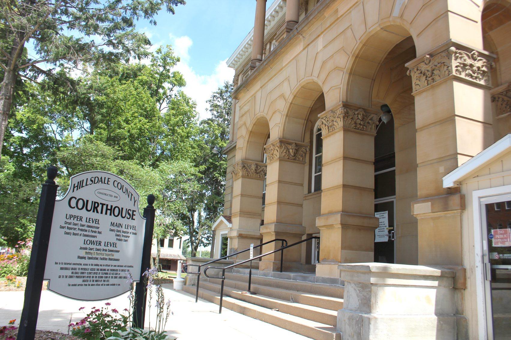 |
Hillsdale County Director of Equalization Hillsdale County Courthouse |
Hillsdale County Courthouse 29 N. Howell Street, Room 2, Hillsdale, MI 49242 | (517)-439-9166 |
The information provided on this website about U.S. States, Counties, and Cities, is compiled from publicly available sources and is made available “as is” for informational purposes only. No representations, warranties or guarantees are made as to the accuracy, adequacy, reliability, currentness, completeness, suitability or applicability of the information contained on this website for any particular purpose. All 3rd party trademarks are for reference purposes only. PublicRecords.com powered by Intelius is a privately owned website and is not a direct source of government records or services and not affiliated with any government agency.
Compiled by: Chris E. | Reviewed by: Blake A. | Last update: 03/13/24
Michigan has a variety of GIS records that are accessible to anyone. These records encompass a wide range of data allowing individuals to access and review available information online. Records can include but are not limited to, land ownership maps, property lines maps, and cadastral mapping information. We compile our resource lists from reliable government agencies to ensure ease in your search.
If you couldn't find the resource you were searching for, go to the Michigan Property & Land Records page for other public records resources. Looking for something other than property and land tax records in Michigan? Search the database of all public records available.
Visit our Contact Us page to report any issues.
Use the citation tool to easily create a properly formatted citation or reference. Select the format you’d like to use and copy the link from the screen below.
The information provided on this website about U.S. States, Counties, and Cities, is compiled from publicly available sources and is made available “as is” for informational purposes only. No representations, warranties or guarantees are made as to the accuracy, adequacy, reliability, currentness, completeness, suitability or applicability of the information contained on this website for any particular purpose. All 3rd party trademarks are for reference purposes only. PublicRecords.com powered by Intelius is a privately owned website and is not a direct source of government records or services and not affiliated with any government agency.
This site contains REAL public records data including criminal records, background reports, photos, court documents, address information, phone numbers, civil judgments, properties owned, social media profiles, and much more.
PublicRecords.com powered by Intelius does not provide consumer reports and is not a consumer reporting agency under the Fair Credit Reporting Act. We provide information (criminal record, address, phone number, property, civil judgment, and more) that can be used to satisfy your curiosity, protect your family, and find the truth about people in your life. To use our site you must certify below that you agree to our Privacy Policy and Terms of Use and will NOT use our site or the information we provide:


