
Conduct a GIS records search in Minnesota using our GIS records resources.
View our GIS records resources for the state of Minnesota. Use these GIS records to search for land ownership maps, cadastral maps, or property line maps. GIS records may contain GIS property search records, property ownership maps, and other public GIS record information.

| County | Resource | Details |
|---|---|---|
|
Search Minnesota Legislative and Congressional district maps by address. |
||
|
Search the Minnesota State Archives for historical public records including legislative records, birth records, death records, maps and court records. |
||
|
View Minnesota traffic maps including roadwork, crashes, and road conditions. |
||
|
View Minnesota GIS maps including county maps, topographic maps, state highway map, and others. |
||
| mower county |
Explore Mower County's GIS services for detailed spatial data and online mapping tools, supporting the needs of local government and public access. |
|
| mower county |
Explore Mower County's interactive maps and geospatial data. Contact us at 201 1st St NE, Austin, MN 55912, call 507-437-9527, or email GISSupport@co.mower.mn.us for GIS assistance. |
|
| mower county |
Explore Mower County's GIS maps for detailed property tax and assessment information. Start with the Search bar for easy navigation. |
|
| mower county |
Explore Mower County's GIS portal for detailed property tax statements and geographical data. Easily navigate property information and tax records online. |
|
| mower county |
Contact the GIS Administrator, Eric Miller, at Mower County for GIS-related inquiries. Reach out via email or phone at 507-437-9584 ext 584. Visit us at 201 1st Street NE, Austin, MN 55912 or call 507-437-9494 for further assistance. |
|
| beltrami county |
Explore Itasca County with interactive GIS maps. Find detailed county highway, plat book, and trail system maps, plus access GIS data downloads. |
|
| beltrami county |
Explore Itasca County's GIS maps and geospatial data through the Surveying & Mapping Department. Access interactive tools like the Corner Card Viewer and Itasca County GIS Viewer for detailed property and geographic information. |
|
| beltrami county |
Explore Itasca County's GIS maps for detailed parcel information, including property tax classifications and valuations, available in a separate window for your convenience. |
|
| beltrami county |
Explore detailed Itasca County GIS maps for comprehensive land ownership and property line information, including parcel boundaries and acreage data provided by Rockford Map. |
|
| beltrami county |
Discover the power of GIS-based parcel maps in Beltrami County for insightful analysis, planning, and informed decision-making. A vital resource for information sharing. |
|
| beltrami county |
Explore Beltrami County with our comprehensive GIS mapping tool. Dive into detailed property, infrastructure, and land information with ease. |
|
| beltrami county |
Explore Beltrami County with our GIS Public Map Service. Discover detailed maps, property information, and more with user-friendly tools. Disclaimer: Beltrami County provides this service without warranties, expressed or implied. |
|
| kittson county |
Kittson County GIS Mapping Portal - Beacon by Schneider Corp |
Explore interactive maps and access property information with the Kittson County GIS portal, provided by The Schneider Corporation. |
| kittson county |
Kittson County GIS & Resources | Kittson County, MN - CivicEngage |
Explore Kittson County's GIS maps, access property tax payment options, job applications, and stay informed with the latest Coronavirus updates. |
| kittson county |
Explore interactive maps and access property information with the Kittson County GIS portal. Find parcel data, zoning, and more for effective land management in Minnesota. |
|
| kittson county |
Explore comprehensive GIS mapping for Kittson County, MN, featuring complete land parcel coverage, property boundaries, and essential data for all county territories. |
|
| kittson county |
Explore detailed GIS maps of Kittson County, Minnesota, provided by MnDOT, including municipal and township boundaries for comprehensive spatial information. |
|
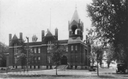
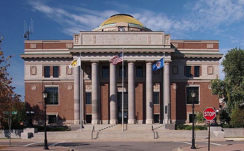
| stearns county |
Search Stearns County property tax and assessment records through a paid subscription including GIS maps. |
|
| stearns county |
Explore Stearns County's interactive GIS maps for detailed property tax information, assessment values, floodplain data, and more. |
|
| stearns county |
Explore Stearns County, MN with our interactive GIS maps. View up-to-date property information, permits, zoning restrictions, and tax statements. Access the online property viewer now. |
|
| stearns county |
Explore a wealth of geographic data with Stearns County's GIS platform, offering free public access to maps and spatial information without any licensing requirements. |
|
| stearns county |
Stearns County Property & Tax Information - GIS Mapping & More |
Explore Stearns County's GIS mapping, property tax assessments, land use permits, and real estate information. Access plats, images, and photos for comprehensive property insights. |
| stearns county |
Explore Stearns County GIS data for property details, appraisal information, and zoning verification. Note: This resource is for reference only and not a substitute for professional property services. |
|
| ramsey county |
View City of Saint Paul Police monthly crime maps. |
|
| ramsey county |
View City of Saint Paul Police yearly crime reports including calls for service, arrest, year-end maps, and more. |
|
| ramsey county |
View City of Saint Paul GIS maps including zoning, plats, survey benchmarks, survey monuments, parks, water resources and others. |
|
| ramsey county |
View City of Saint Paul maps including floodplain maps, neighborhood map, section maps, ward maps, park maps, recreation maps, and others. |
|
| ramsey county |
View Ramsey County recorded plats and surveyor section coordinates, corner ties, and more. |
|
| ramsey county |
View Ramsey County GIS maps including historic aerials, commissioner districts map, flood zone maps, municipalities, parcel maps, and others. |
|
| hennepin county |
Search Hennepin County property tax and assessment records by address, property ID number, and addition name including interactive GIS maps. |
|
| hennepin county |
Search City of Bloomington tax parcels through GIS maps. |
|
| hennepin county |
View information about City of Bloomington cemetery regulations and maps including fees. |
|
| hennepin county |
Search City of Bloomington construction project maps by address. |
|
| hennepin county |
Search City of Bloomington Police crime maps by crimes reported within last 90 days or address. |
|
| hennepin county |
View maps of the City of Bloomington legislative districts and precincts, City Council districts and precincts, and precinct boundaries. |
|
| hennepin county |
Search City of Brooklyn Park Police crime maps by crime types, date, or address. |
|
| hennepin county |
View City of Eden Prairie election information including districts map, and interactive polling locations map. Subscribe to get email notice for election updates. |
|
| hennepin county |
Search City of Eden Prairie facility directory through GIS maps by category, amenity, capacity and availability. |
|
| hennepin county |
Search City of Maple Grove Police crime maps by address or by crime type such as burglaries, robberies, arsons, thefts, and others reported within last 90 days. |
|
| hennepin county |
View City of Maple Grove maps including parks and trail map, city map, school districts, interactive maps, and others. |
|
| hennepin county |
Search Hennepin County Commissioner and district locator map by street address. |
|
| hennepin county |
View Hennepin County election results including interactive map. |
|
| hennepin county |
View Hennepin County maps including county bike map, highway map, traffic flow map, and historic plats and maps. |
|
| hennepin county |
View City of Bloomington Police news releases including recent criminal activity. |
|
| wright county |
Search Wright County property records including traffic count maps, highway map, weight restriction map, and others. |
|
| winona county |
View Winona County maps including municipalities zoning maps, township maps, municipalities land use maps, road maps, ambulance districts, fire department districts, and others. |
|
| winona county |
Search Winona County survey records including township plats, township survey data maps, survey index, county right of way maps, township road maps, and others. |
|
| wilkin county |
View Wilkin County GIS maps and Parcel Search including township maps, municipality maps, school district maps, and others. |
|
| washington county |
View and search Washington County parcels by street address or property identification number (PIN)including mortgage foreclosures, aerial photos, and more. |
|
| washington county |
View Washington County survey records including parcel maps, aerial photos, section corners, survey archives, zoning maps, and more. |
|
| wadena county |
Search Wadena County property tax and assessment records by parcel number, address, or road intersection through GIS maps. |
|
| wabasha county |
Search Wabasha County property tax and assessment records by name, address or parcel number, section-township-range, including GIS map. |
|
| wabasha county |
View various maps of Wabasha County, including Commissioner districts, ambulance zones, fire department zones, rural addressing, school district, and county road maps. |
|
| st louis county |
View City of Duluth City Council precinct maps and Council district maps. |
|
| st louis county |
View City of Duluth traffic maps including accidents, road conditions and roadwork. |
|
| st louis county |
Search St. Louis County historical records including books, maps, photographs, memorabilia and more. |
|
| st louis county |
View St. Louis County maps including county and cities map, regional base map, zip codes map, city and township maps, and others. |
|
| sherburne county |
Search Sherburne County property assessment records, plats, and parcel maps. |
|
| sherburne county |
Search City of St. Cloud property tax records through GIS maps. |
|
| sherburne county |
View City of St. Cloud City Council ward map including polling place locator. |
|
| scott county |
View Scott County Sheriff crime maps. |
|
| scott county |
View Scott County environmental maps including aerial photos, water wells, wellhead protection areas, wetland inventory, floodplain maps, and more. |
|
| scott county |
View Scott County GIS maps including highway maps, city street map, topography map, commissioner district map, school district map, land use maps, and more. |
|
| scott county |
View Scott County plats and surveys including land parcel mapping and more. |
|
| scott county |
View Scott County yearly traffic volume maps from 2004 to present. |
|
| roseau county |
Search Roseau County property tax and assessment records through GIS mapping. |
|
| rice county |
Search Rice County property assessment records and parcel maps by address, plat, or parcel ID. |
|
| pipestone county |
Search Pipestone County property records through GIS maps. |
|
| pipestone county |
View Pipestone County GIS maps including Commissioner districts, county roads, school districts, and soil survey map. |
|
| pine county |
Search Pine County property tax and assessment records including recorded plats and surveys including GIS maps. |
|
| otter tail county |
Search Otter Tail County property tax and assessment records by parcel number, house number or street number including GIS maps. |
|
| olmsted county |
Search Olmsted County property tax and assessment records by address, property ID, section-township-range or through GIS maps or pay property taxes online. |
|
| olmsted county |
View Olmsted County GIS maps including property information, election information, zoning information, school district information and emergency services maps. |
|
| olmsted county |
View Olmsted County plat maps, survey data maps, and right of way maps. |
|
| nobles county |
View Nobles County recorded survey section corner information. |
|
| nicollet county |
View Nicollet County maps including maps of cities and townships, Commissioner districts map, highway maps, and more. |
|
| murray county |
View Murray County GIS maps including parcel search, municipal boundaries, transportation and more. |
|
| morrison county |
Search Morrison County property tax and assessment records through GIS maps including townships, school districts, Commissioner districts, and others. |
|
| morrison county |
View Morrison County maps including Commissioner districts map, historical highway map, bike trail map, and others. |
|
| mcleod county |
Search McLeod County property tax and assessment records by parcel number or property address through GIS maps. |
|
| mcleod county |
View McLeod County maps including traffic count maps, aerial photos, school district maps, topographic contour maps, township maps, and more. |
|
| mcleod county |
View McLeod County GIS maps including parcels, plats, land features, transportation, and more. |
|
| mcleod county |
Search McLeod County recorded plats and surveys. |
|
| martin county |
Search Martin County property records and parcel maps by name, address, or parcel ID. |
|
| lyon county |
Search Lyon County property tax and assessment records through GIS maps. |
|
| le sueur county |
Search Le Sueur County property tax and assessment records through GIS maps. |
|
| lake county |
View Lake County information about tax forfeited land sales including list of properties and maps. |
|
| lake county |
View Lake County maps such as County highway map, snow plow route maps, and more. |
|
| koochiching county |
View Koochiching County GIS maps. |
|
| koochiching county |
View Koochiching County voter registration and election information including precinct finder, Commissioner district maps and election results. |
|
| kanabec county |
Search Kanabec County property tax and assessment records by name, parcel ID, location and plat name including GIS maps. |
|
| itasca county |
View Itasca County Commissioner district maps. |
|
| itasca county |
Search Itasca County recorded plats and surveys. |
|
| isanti county |
Search interactive Isanti County GIS map for property sales and assessments records. Search by parcel number or address, plat name and more. |
|
| hubbard county |
Search Hubbard County property tax and assessment records through GIS maps. |
|
| houston county |
Search Houston County property tax and assessment records through GIS maps. |
|
| goodhue county |
Search Goodhue County plats and surveys such as cemeteries, city and town roads, county row maps, Minnesota dept. transportation plats, registered land surveys and more. |
|
| goodhue county |
View Goodhue County voter registration and election information including polling place locator, district maps, absentee ballot status search, and more. |
|
| freeborn county |
Search Freeborn County property tax and assessment records through GIS maps. |
|
| faribault county |
Search Faribault County property tax and assessment records through GIS maps. |
|
| faribault county |
View Faribault County GIS maps such as boundary maps, transportation maps including state highways, county roads, city roads, water features, and more. |
|
| douglas county |
View Douglas County land survey maps. |
|
| dodge county |
View Dodge County GIS maps including property search. Maps including roads, streams, corporate limits, townships, and imagery. |
|
| dodge county |
View Dodge County maps including general county map, highway map, and others. |
|
| dakota county |
Search Dakota County property tax and assessment records through GIS maps. |
|
| dakota county |
View City of Apple Valley maps including street map, zoning map, parks and trails, transportation maps, 2030 land use maps and others. |
|
| dakota county |
View maps of the City of Eagan for parks, trails, schools, fires stations, polling locations and precincts, zoning maps and more. |
|
| dakota county |
Search Dakota County mortgage foreclosure properties through GIS maps by house number and date. |
|
| dakota county |
View Dakota County GIS maps including foreclosure sales maps, municipalities map, and others. |
|
| dakota county |
View Dakota County maps including trail maps, historic county maps, foreclosure sale maps, interactive maps and more. |
|
| dakota county |
Search Dakota County plats and surveys. |
|
| dakota county |
View Dakota County survey control and breakdowns through GIS maps. |
|
| crow wing county |
View Crow Wing County aerial photo maps. |
|
| crow wing county |
Search Crow Wing County property tax and assessment records through GIS maps. |
|
| crow wing county |
View Crow Wing County highway map. |
|
| cottonwood county |
Search Cottonwood County property tax and assessment records by name, address, parcel ID and through GIS maps. |
|
| cottonwood county |
View Cottonwood County Highway Department maps including municipalities map, weight restriction map, and others. |
|
| cook county |
View Cook County GIS maps including township maps, community maps, boundary maps, and others. |
|
| cook county |
View Cook County maps including commissioner district maps, voter precinct maps, and others. |
|
| clearwater county |
Search Clearwater County property tax and assessment records through GIS maps. |
|
| clearwater county |
Search Clearwater County certificate of surveys and recorded plats and subdivisions. |
|
| clay county |
Search Clay County property tax and assessment records through GIS maps. |
|
| clay county |
View Clay County GIS maps including address maps, township maps, school district maps, and others. |
|
| clay county |
View Clay County road map and bridges map. |
|
| clay county |
Search Clay County plat maps and survey corners online. |
|
| chisago county |
View Chisago County GIS maps including parcel search by owner name, address or parcel number. |
|
| carver county |
Search Carver County property tax and assessment records through GIS maps or pay property taxes online. |
|
| carver county |
View Carver County Sheriff crime maps. |
|
| brown county |
Search Brown County property tax and assessment records through GIS maps. |
|
| brown county |
View Brown County highway maps such as road project maps, weight restriction road maps, MN DOT maps and others. |
|
| blue earth county |
Search Blue Earth County property tax and assessment records by address, house number, street name and city, parcel ID including GIS maps. |
|
| blue earth county |
View Blue Earth County maps including parcel maps, highway map, zoning maps, and others. |
|
| becker county |
Search Becker County property tax and assessment records through GIS maps including parcel number, owner number and address. |
|
| becker county |
View Becker County highway maps including road closure map, traffic volume map, and others. |
|
| becker county |
Search Becker County plat maps by name. |
|
| becker county |
Search Becker County survey records by township. |
|
| anoka county |
View City of Coon Rapids voter registration and election information including precinct map. |
|
| anoka county |
View Anoka County maps including parks, regional trails, recreation centers, and more. |
|
| aitkin county |
Search Aitkin County property tax and assessment records through GIS maps. |
The information provided on this website about U.S. States, Counties, and Cities, is compiled from publicly available sources and is made available “as is” for informational purposes only. No representations, warranties or guarantees are made as to the accuracy, adequacy, reliability, currentness, completeness, suitability or applicability of the information contained on this website for any particular purpose. All 3rd party trademarks are for reference purposes only. PublicRecords.com powered by Intelius is a privately owned website and is not a direct source of government records or services and not affiliated with any government agency.
Below, you will find a list of offices in Minnesota that may hold GIS maps. When requesting GIS records from these offices, it's important to be aware of any procedures, requirements, and fees associated with obtaining the records. Contacting the respective office directly will provide you with the most accurate and up-to-date information regarding access to GIS records in Minnesota.
| Image | Office | Address | Phone |
|---|---|---|---|
 |
151 4th St. SE, Rochester, MN 55904 | (507)-328-7670 | |
 |
213 - 1st Avenue SE, Little Falls, MN 56345 | (320)-632-0101 | |
 |
520 Chandler Ave N, Glencoe, MN 55336 | (320)-864-5551 | |
 |
Hennepin County Government Center 300 South Sixth St., Minneapolis, MN 55487 | (612)-348-3046 | |
 |
1800 West Old Shakopee Road, Bloomington, MN 55431 | (952)-563-8724 | |
 |
Sherburne County Assessor Sherburne County Government Center |
13880 Business Ctr Dr NW, Elk River, MN 55330 | (763)-765-4900 |
 |
400 Second St. S., St. Cloud, MN 56301 | (320)-255-7203 | |
 |
915 Lake Avenue, Detroit Lakes, MN 56501 | (218)-846-7300 | |
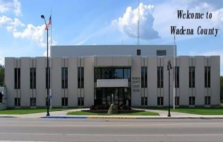 |
415 Jefferson St. South, Wadena, MN 56482 | (218)-631-7628 | |
 |
625 Jefferson Ave., Wabasha, MN 55981 | (651)-565-3669 | |
 |
(320)-656-3680 | ||
 |
416 S. Hiawatha Ave., Pipestone, MN 56164 | (507)-825-6750 | |
 |
900 3rd Avenue, Windom, MN 56101 | (507)-831-2458 | |
 |
505 W. Fir Ave., Fergus Falls, MN 56537 | (218)-998-8010 | |
 |
213 Main Avenue N., Dept. 203, Bagley, MN 56621 | (218)-694-6260 | |
 |
411 S. Broadway, Albert Lea, MN 56007 | (507)-377-5176 | |
 |
1590 Highway 55, Hastings, MN 55033 | (651)-438-4200 | |
 |
322 Laurel St, Brainerd, MN 56401 | (218)-824-1125 | |
 |
(218)-299-5017 | ||
 |
204 S. 5th St., Mankato, MN 56002 | (507)-304-4251 |
The information provided on this website about U.S. States, Counties, and Cities, is compiled from publicly available sources and is made available “as is” for informational purposes only. No representations, warranties or guarantees are made as to the accuracy, adequacy, reliability, currentness, completeness, suitability or applicability of the information contained on this website for any particular purpose. All 3rd party trademarks are for reference purposes only. PublicRecords.com powered by Intelius is a privately owned website and is not a direct source of government records or services and not affiliated with any government agency.
Compiled by: Chris E. | Reviewed by: Blake A. | Last update: 03/13/24
Minnesota has a variety of GIS records that are accessible to anyone. These records encompass a wide range of data allowing individuals to access and review available information online. Records can include but are not limited to, land ownership maps, property lines maps, and cadastral mapping information. We compile our resource lists from reliable government agencies to ensure ease in your search.
If you couldn't find the resource you were searching for, go to the Minnesota Property & Land Records page for other public records resources. Looking for something other than property and land tax records in Minnesota? Search the database of all public records available.
Visit our Contact Us page to report any issues.
Use the citation tool to easily create a properly formatted citation or reference. Select the format you’d like to use and copy the link from the screen below.
The information provided on this website about U.S. States, Counties, and Cities, is compiled from publicly available sources and is made available “as is” for informational purposes only. No representations, warranties or guarantees are made as to the accuracy, adequacy, reliability, currentness, completeness, suitability or applicability of the information contained on this website for any particular purpose. All 3rd party trademarks are for reference purposes only. PublicRecords.com powered by Intelius is a privately owned website and is not a direct source of government records or services and not affiliated with any government agency.
This site contains REAL public records data including criminal records, background reports, photos, court documents, address information, phone numbers, civil judgments, properties owned, social media profiles, and much more.
PublicRecords.com powered by Intelius does not provide consumer reports and is not a consumer reporting agency under the Fair Credit Reporting Act. We provide information (criminal record, address, phone number, property, civil judgment, and more) that can be used to satisfy your curiosity, protect your family, and find the truth about people in your life. To use our site you must certify below that you agree to our Privacy Policy and Terms of Use and will NOT use our site or the information we provide:


