
Conduct a GIS records search in Montana using our GIS records resources.
View our GIS records resources for the state of Montana. Use these GIS records to search for land ownership maps, cadastral maps, or property line maps. GIS records may contain GIS property search records, property ownership maps, and other public GIS record information.

| County | Resource | Details |
|---|---|---|
|
Search Western States marriage records ranging from the pre1900s to the 1930s. |
||
|
View Montana traffic cameras, alerts, restrictions, and closures including maps and mobile app. |
||
|
Search Montana property records by county and name through GIS cadastral mapping. |
||
| yellowstone county |
View various maps of the City of Billings, including Council districts, voting wards, cemetery, and stormwater system maps. |
|
| yellowstone county |
View information about City of Billings Mountview Cemetery printable map of cemetery. |
|
| yellowstone county |
Search Yellowstone County property tax and assessment records through GIS mapping. |
|
| yellowstone county |
Search or view the City of Billings crime incident map. |
|
| wibaux county |
Search Wibaux County property tax and assessment records through GIS mapping. |
|
| wheatland county |
Search Wheatland County property tax and assessment records through GIS mapping. |
|
| valley county |
Search Valley County property tax and assessment records through GIS mapping. |
|
| treasure county |
Search Treasure County property tax and assessment records through GIS mapping. |
|
| toole county |
Search Toole County property tax and assessment records through GIS mapping. |
|
| teton county |
View Teton County GIS maps including county roads map, Teton River floodplain map, and other maps. |
|
| teton county |
Search Teton County property tax and assessment records through GIS mapping. |
|
| sweet grass county |
View Sweet Grass County floodplain information and floodplain maps. |
|
| sweet grass county |
Search Sweet Grass County property tax and assessment records through GIS mapping. |
|
| sweet grass county |
View Sweet Grass County maps including county road map, sewer water map, zoning map and other maps. |
|
| stillwater county |
Search Stillwater County property tax and assessment records through GIS mapping. |
|
| silver bow county |
View various maps of the City and County of Butte-Silver Bow, such as street, commission districts, emergency service zones, future land use, and polling locations. |
|
| silver bow county |
View the City and County of Butte-Silver Bow floodplain information and floodplain maps. |
|
| silver bow county |
Search the City and County of Butte-Silver Bow property tax and assessment records through GIS mapping. |
|
| sheridan county |
Search Sheridan County property tax and assessment records through GIS mapping. |
|
| sanders county |
Search Sanders County property tax and assessment records through GIS mapping. |
|
| rosebud county |
Search Rosebud County property tax and assessment records through GIS mapping. |
|
| roosevelt county |
Search Roosevelt County property tax and assessment records through GIS mapping. |
|
| richland county |
Search Richland County property tax and assessment records through GIS mapping. |
|
| ravalli county |
View Ravalli County floodplain rules and regulations, floodplain hazard maps, obtain floodplain permit application and complaint forms for subdivision, zoning and floodplain issues. |
|
| ravalli county |
Search Ravalli County property tax and assessment records through GIS mapping. |
|
| prairie county |
Search Prairie County property tax and assessment records through GIS mapping. |
|
| powell county |
View Powell County interactive voting district map. |
|
| powell county |
Search Powell County property tax and assessment records through GIS mapping. |
|
| powder river county |
View Powder River County voter registration and election information, including election calendar, and precinct map. |
|
| powder river county |
Search Powder River County property tax and assessment records through GIS mapping. |
|
| pondera county |
Search Pondera County property tax and assessment records through GIS mapping. |
|
| phillips county |
Search Phillips County property tax and assessment records through GIS mapping. |
|
| petroleum county |
Search Petroleum County property tax and assessment records through GIS mapping. |
|
| park county |
View Park County voter and election information including voter registratin search, absentee ballot information and commissioner district maps. |
|
| park county |
Search Park County GIS map for property tax and assessment records. Search by owner name, assessment number, address, or county. |
|
| park county |
View interactive and static Park County GIS maps including property ownership and values, roads, topographic, school districts, and fire districts. |
|
| musselshell county |
Search Musselshell County property tax and assessment records through GIS mapping. |
|
| missoula county |
View various maps of the City of Missoula including boundary maps, Council district maps, and other maps. |
|
| missoula county |
View Missoula County voter registration and election information, including election maps, election centers, election results, and more. |
|
| missoula county |
Search the City of Missoula parcels, addresses, public assistance, and sewer information through GIS maps. |
|
| missoula county |
View information about the City of Missoula cemetery maps and internment listing. |
|
| missoula county |
Search Missoula County property tax and assessment records through GIS mapping. |
|
| missoula county |
View various GIS maps of Missoula County, including property information maps, parcel maps, boundary maps, addresses, CAD data, imagery, and other maps. |
|
| missoula county |
Search updated Missoula County property records through GIS mapping. |
|
| mineral county |
Search Mineral County property tax and assessment records through GIS mapping. |
|
| meagher county |
Search Meagher County property tax and assessment records through GIS mapping. |
|
| mccone county |
Search McCone County property tax and assessment records through GIS mapping. |
|
| madison county |
View Madison County floodplain information, including topography maps for flood prone areas. |
|
| madison county |
Search Madison County property tax and assessment records through GIS mapping. |
|
| lincoln county |
Search Lincoln County property tax and assessment records through GIS mapping. |
|
| liberty county |
Search Liberty County property tax and assessment records through GIS maps. |
|
| lewis and clark county |
Search Lewis and Clark County property tax and assessment records by owner name, address, subdivision, or township, range and section. |
|
| lake county |
Search Lake County property tax and assessment records through GIS mapping. |
|
| lake county |
View current Lake County survey plats. |
|
| judith basin county |
Search Judith Basin County property tax and assessment records through GIS mapping. |
|
| jefferson county |
Search Jefferson County property tax and assessment records through GIS mapping. |
|
| hill county |
Search Hill County property tax and assessment records through GIS mapping. |
|
| granite county |
Search Granite County property tax and assessment records through GIS mapping. |
|
| golden valley county |
Search Golden Valley County property tax and assessment records through GIS mapping. |
|
| glacier county |
Search Glacier County property tax and assessment records through GIS mapping. |
|
| garfield county |
Search Garfield County property tax and assessment records through GIS mapping. |
|
| gallatin county |
Search Gallatin County property tax and assessment through GIS mapping. |
|
| flathead county |
Search Flathead County property tax and assessment records through GIS mapping. |
|
| fergus county |
Search Fergus County property assessment records and parcel maps by owner name, assessment code, or address. |
|
| fallon county |
Search Fallon County property appraisal records and parcel maps by owner name, assessment code, or certificate of survey. |
|
| deer lodge county |
Search Anaconda - Deer Lodge County property tax and assessment records through GIS mapping. |
|
| dawson county |
Search Dawson County property tax and assessment records through GIS mapping. |
|
| daniels county |
Search Daniels County property tax and assessment records through GIS mapping. |
|
| custer county |
Search Custer County property tax and assessment records through GIS mapping. |
|
| chouteau county |
Search Chouteau County property tax and assessment records through GIS mapping. |
|
| cascade county |
View various GIS maps of the City of Great Falls, including interactive basemap, neighborhood councils, airport vicinity, and trail maps. |
|
| cascade county |
View Cascade County polling locations. |
|
| cascade county |
View Cascade County building regulations, floodplain information and zoning map book. |
|
| cascade county |
Search Cascade County recorded documents such as recorded plats, surveys, land titles or deeds. |
|
| cascade county |
Search Cascade County property records through GIS maps. |
|
| cascade county |
View various interactive and static GIS maps of Cascade County, such as rural address and road atlas, wind speed, and wind power maps. |
|
| carter county |
Search Carter County property tax and assessment records through GIS mapping. |
|
| carbon county |
Search Carbon County property tax and assessment records through GIS maps. |
|
| broadwater county |
Search Broadwater County property tax and assessment records through GIS mapping. |
|
| blaine county |
Search Blaine County property tax and assessment records through GIS mapping. |
|
| big horn county |
View Big Horn County crime map by date range or location includes crime type, most wanted persons, missing persons, warrants, arrests, and more. |
|
| big horn county |
Search Big Horn County property records through GIS mapping. |
|
| beaverhead county |
Search Beaverhead County property records through GIS mapping. |
The information provided on this website about U.S. States, Counties, and Cities, is compiled from publicly available sources and is made available “as is” for informational purposes only. No representations, warranties or guarantees are made as to the accuracy, adequacy, reliability, currentness, completeness, suitability or applicability of the information contained on this website for any particular purpose. All 3rd party trademarks are for reference purposes only. PublicRecords.com powered by Intelius is a privately owned website and is not a direct source of government records or services and not affiliated with any government agency.
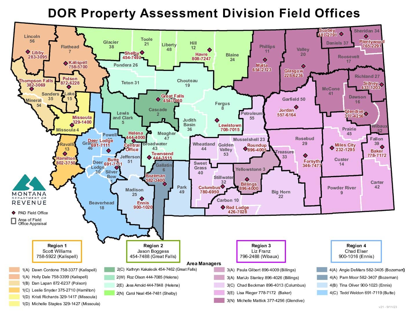
Below, you will find a list of offices in Montana that may hold GIS maps. When requesting GIS records from these offices, it's important to be aware of any procedures, requirements, and fees associated with obtaining the records. Contacting the respective office directly will provide you with the most accurate and up-to-date information regarding access to GIS records in Montana.
| Image | Office | Address | Phone |
|---|---|---|---|
 |
226 1st St. South, Shelby, MT 59474 | (406)-424-8320 | |
 |
352 Leavitt Ave., Jordan, MT 59337 | (406)-557-6164 | |
 |
1010 Main Street, Miles City, MT 59301 | (406)-874-3427 | |
 |
420 Ohio St., Chinook, MT 59523 | (406)-357-3210 | |
 |
414 East Callender St., Livingston, MT 59047 | (406)-222-4110 | |
 |
1 North Main St., Choteau, MT 59422 | (406)-466-3976 | |
 |
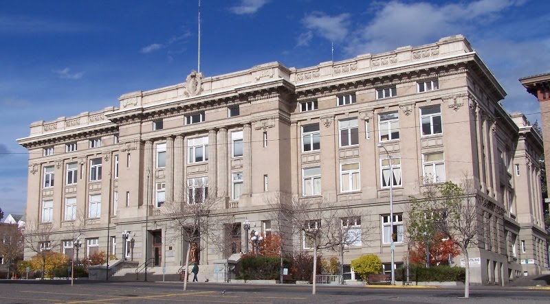
121 4th St. North, Suite #1B-1, Great Falls, MT 59401 | (406)-454-6801 | |
 |
121 4th St N, Great Falls, MT 59401 | (406)-454-6850 | |
 |
1 Main St., Courthouse Square, Broadus, MT 59317 | (406)-436-2407 | |
 |
1 Main St., Courthouse Square, Broadus, MT 59317 | (406)-436-2444 | |
 |
115 W 5th Street - Annex Bldg., Big Timber, MT 59011 | (406)-932-5149 | |
 |
City and County of Butte-Silver Bow Assessor Butte-Silver Bow Courthouse, Room |
155 West Granite St., Butte, MT 59701 | (406)-497-6290 |
 |
20 4th Ave. SW, Conrad, MT 59425 | (406)-271-4012 | |
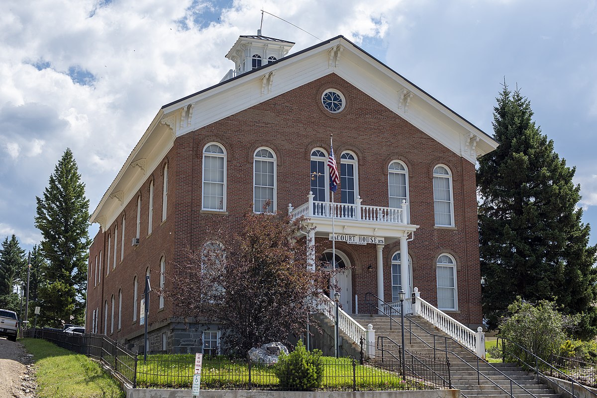 |
5 Placer Loop, Virginia City, MT 59755 | (406)-843-5630 | |
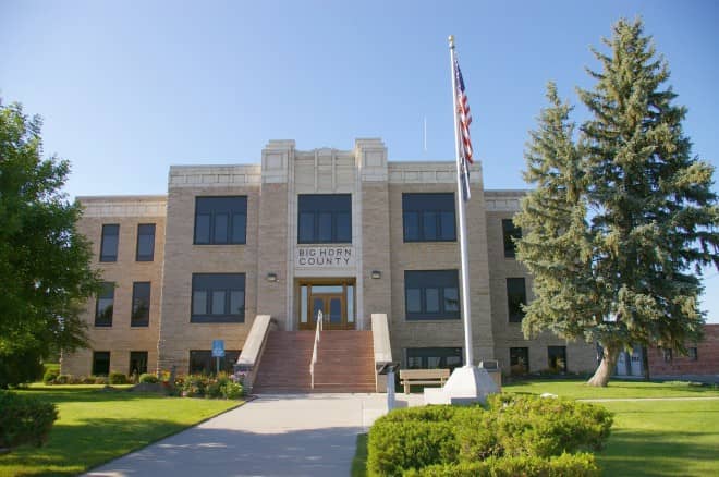 |
121 W. 3rd St., Room 204, West, Hardin, MT 59034 | (406)-665-9830 |
The information provided on this website about U.S. States, Counties, and Cities, is compiled from publicly available sources and is made available “as is” for informational purposes only. No representations, warranties or guarantees are made as to the accuracy, adequacy, reliability, currentness, completeness, suitability or applicability of the information contained on this website for any particular purpose. All 3rd party trademarks are for reference purposes only. PublicRecords.com powered by Intelius is a privately owned website and is not a direct source of government records or services and not affiliated with any government agency.
Compiled by: Chris E. | Reviewed by: Blake A. | Last update: 03/13/24
Montana has a variety of GIS records that are accessible to anyone. These records encompass a wide range of data allowing individuals to access and review available information online. Records can include but are not limited to, land ownership maps, property lines maps, and cadastral mapping information. We compile our resource lists from reliable government agencies to ensure ease in your search.
If you couldn't find the resource you were searching for, go to the Montana Property & Land Records page for other public records resources. Looking for something other than property and land tax records in Montana? Search the database of all public records available.
Visit our Contact Us page to report any issues.
Use the citation tool to easily create a properly formatted citation or reference. Select the format you’d like to use and copy the link from the screen below.
The information provided on this website about U.S. States, Counties, and Cities, is compiled from publicly available sources and is made available “as is” for informational purposes only. No representations, warranties or guarantees are made as to the accuracy, adequacy, reliability, currentness, completeness, suitability or applicability of the information contained on this website for any particular purpose. All 3rd party trademarks are for reference purposes only. PublicRecords.com powered by Intelius is a privately owned website and is not a direct source of government records or services and not affiliated with any government agency.
This site contains REAL public records data including criminal records, background reports, photos, court documents, address information, phone numbers, civil judgments, properties owned, social media profiles, and much more.
PublicRecords.com powered by Intelius does not provide consumer reports and is not a consumer reporting agency under the Fair Credit Reporting Act. We provide information (criminal record, address, phone number, property, civil judgment, and more) that can be used to satisfy your curiosity, protect your family, and find the truth about people in your life. To use our site you must certify below that you agree to our Privacy Policy and Terms of Use and will NOT use our site or the information we provide:


