
Conduct an environmental health records search in Oregon using our environmental health records resources.
View our environmental health records resources for the state of Oregon. Use these environmental health records to view flood zone maps, conduct a permit search, and to search for other essential data about environmental health. Environmental health records may contain flood zone areas, permit search help, GIS mapping resources, and other environmental health information.

| County | Resource | Details |
|---|---|---|
|
Search the Oregon Department of Environmental Quality databases and interactive GIS mapping applications including air and water quality monitoring data, enforcement actions, environmental cleanup sites, leaking underground storage tank cleanup sites, underground injection control, regulated or permitted facilities and sites, and wastewater permits. |
||
| yamhill county |
Search interactive Yamhill County GIS maps for property information, fire districts, flood plains, planning zones, soils, surveys, donation land claims, GPS corners, and partitions. Search by account number, map, taxlot number, owner name, or address. |
|
| washington county |
View the City of Beaverton drinking water quality reports by date from 2000 to present. |
|
| washington county |
Search interactive GIS maps of the City of Tigard for property assessment and tax lot information, building permits, crime data, districts and boundaries, natural hazards, aerial photos, active construction projects, zoning and environmental information. Search by address or street intersection. |
|
| washington county |
View the City of Tigard annual water quality reports. |
|
| tillamook county |
View Tillamook County GIS maps including aerial photos, FEMA flood insurance rate, tsunami brochures and maps, and tax maps. |
|
| polk county |
View interactive and static Polk County GIS maps including property assessments, boundaries, elevation, fire districts, floodplains, school districts, and zoning maps, and online access to static maps and geographic information. |
|
| multnomah county |
Search interactive City of Portland GIS map for property assessments, aerial photos, building permits, crime incidents, census data, elevation, zoning, underground storage tanks, and schools by street address or intersection. |
|
| multnomah county |
View the City of Portland Willamette River monthly water quality test results from eight sampling locations. |
|
| multnomah county |
View the City of Portland annual drinking water quality reports. |
|
| multnomah county |
Search interactive Multnomah County GIS maps including zoning, assessor data, census tracts, historical and current surveys, boundaries, watersheds, and voting precinct maps, and more. |
|
| marion county |
View the City of Salem GIS interactive map gallery such as addresses, boundaries, traffic, emergencies, historic areas, and more. |
|
| linn county |
View various static City of Albany GIS maps such as aerial photos, City Council wards, historic districts, floodplain, neighborhoods, topography, voting precincts, school boundaries, and zoning maps. |
|
| linn county |
View the City of Albany annual water quality report. |
|
| lane county |
View various City of Eugene maps including crime incident, neighborhood associations, voting wards, zoning, historic sites, and wetland maps. |
|
| jackson county |
View the City of Medford GIS maps and data files by voting wards, crime incidents, zoning and land use, streams, FEMA flood plains, boundaries, fire stations, and police beats. |
|
| jackson county |
View Jackson County interactive and static GIS maps including property assessments and data, recorded survey documents, census, community fuels treatment, Red Cross shelters, environmental boundaries, watersheds, and voter precincts. |
|
| deschutes county |
Search information for Deschutes County Community Development Department's interactive mapping application for property tax statements, sales history, assessments, land use, zoning reports, and water reports. Search by account number, tax lot number, address, or owner name. |
|
| clatsop county |
Search interactive Clatsop County GIS map for tax statements, appraisals, surveys, hazard areas, flood plains, zoning, elevations, and voting precincts. Static maps such as roads and watersheds are also available. |
|
| benton county |
Search interactive City of Corvallis GIS map by address for features such as assessment and ownership, political districts, land use, floodplains, and historical districts, and more. Static maps such as election precincts, congressional districts and land use maps are also provided. |
The information provided on this website about U.S. States, Counties, and Cities, is compiled from publicly available sources and is made available “as is” for informational purposes only. No representations, warranties or guarantees are made as to the accuracy, adequacy, reliability, currentness, completeness, suitability or applicability of the information contained on this website for any particular purpose. All 3rd party trademarks are for reference purposes only. PublicRecords.com powered by Intelius is a privately owned website and is not a direct source of government records or services and not affiliated with any government agency.
Below, you will find a list of offices in Oregon that may hold environmental health records. When requesting environmental health records from these offices, it's important to be aware of any procedures, requirements, and fees associated with obtaining the records. Contacting the respective office directly will provide you with the most accurate and up-to-date information regarding access to environmental health records in Oregon.
| Image | Office | Address | Phone |
|---|---|---|---|
 |
120 S Main Street, Heppner, OR 97836 | (541)-676-5421 | |
 |
430 W Linden Way, Heppner, OR 97836 | (855)-651-9160 | |
 |
302 Scott St, Moro, OR 97039 | (541)-565-3403 | |
 |
1109 June Street, Hood River, OR 97031 | (541)-386-1115 | |
 |
3007 Experiment Station Dr, Hood River, OR 97031 | (541)-386-4588 | |
 |
758 NW 1st Street, Enterprise, Oregon 97828 | (541)-426-4848 | |
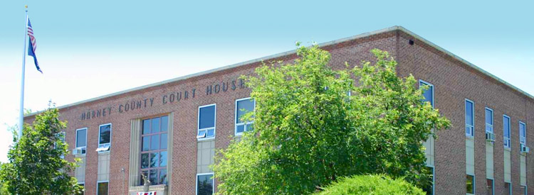 |
530 US-20, Hines, OR 97738 | (541)-573-5010 | |
.jpg) |
40535 OR-19, Fossil, OR 97830 | (541)-468-2990 | |
 |
2325 River Rd # 3, The Dalles, OR 97058 | (541)-296-6178 | |
 |
10507 N McAlister Rd, La Grande, OR 97850 | (541)-963-1313 | |
 |
1 SW Nye Ave, Pendleton, OR 97801 | (541)-276-8049 | |
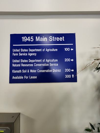 |
1945 Main St #200, Klamath Falls, OR 97601 | (541)-882-5409 | |
 |
625 SE Salmon Ave # 6, Redmond, OR 97756 | (541)-923-4358 | |
|
625 SE Salmon Ave # 7, Redmond, OR 97756 | ||
 |
498 SE Lynn Blvd, Prineville, OR 97754 | (541)-447-3548 | |
 |
1655 1st St, Baker City, OR 97814 | (541)-524-2039 |
The information provided on this website about U.S. States, Counties, and Cities, is compiled from publicly available sources and is made available “as is” for informational purposes only. No representations, warranties or guarantees are made as to the accuracy, adequacy, reliability, currentness, completeness, suitability or applicability of the information contained on this website for any particular purpose. All 3rd party trademarks are for reference purposes only. PublicRecords.com powered by Intelius is a privately owned website and is not a direct source of government records or services and not affiliated with any government agency.
Compiled by: Chris E. | Reviewed by: Blake A. | Last update: 03/13/24
Oregon has a variety of environmental health records that are accessible to anyone. These records encompass a wide range of data allowing individuals to access and review available information online. Records can include but are not limited to, flood zone maps, permit searches, and other environmental health information. We compile our resource lists from reliable government agencies to ensure ease in your search.
If you couldn't find the resource you were searching for, go to the Oregon Legal and Government Records page for other public records resources. Looking for something other than legal and governement records in Oregon? Search the database of all public records available.
Visit our Contact Us page to report any issues.
Use the citation tool to easily create a properly formatted citation or reference. Select the format you’d like to use and copy the link from the screen below.
The information provided on this website about U.S. States, Counties, and Cities, is compiled from publicly available sources and is made available “as is” for informational purposes only. No representations, warranties or guarantees are made as to the accuracy, adequacy, reliability, currentness, completeness, suitability or applicability of the information contained on this website for any particular purpose. All 3rd party trademarks are for reference purposes only. PublicRecords.com powered by Intelius is a privately owned website and is not a direct source of government records or services and not affiliated with any government agency.
This site contains REAL public records data including criminal records, background reports, photos, court documents, address information, phone numbers, civil judgments, properties owned, social media profiles, and much more.
PublicRecords.com powered by Intelius does not provide consumer reports and is not a consumer reporting agency under the Fair Credit Reporting Act. We provide information (criminal record, address, phone number, property, civil judgment, and more) that can be used to satisfy your curiosity, protect your family, and find the truth about people in your life. To use our site you must certify below that you agree to our Privacy Policy and Terms of Use and will NOT use our site or the information we provide:


